
Code: 54783
Date: 1669
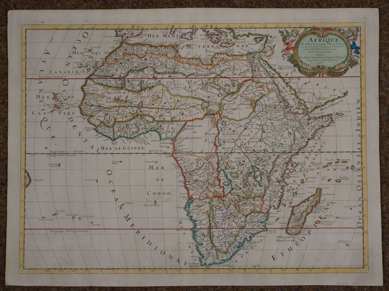
Long title: Afrique Par N. Sanson Geographe ordinaire du Roy, corrigee et changee en plusieurs endroits - suivant les Relations les plus recentes ; par le Sr Sanson le Fils A Paris, Chez Pierre Mariette rue S Lacques a l’Esperance avec privilege de S. Maj po 20.ans 1669
Sanson's second map of Africa, with corrections and improvements made by his son, Guillaume Sanson. Overall sheet size: 60cms x 44.9 cms; image size: 558mm x 403mm. Many of the new place names reflect the increasing French influence on the continent. Madagascar has the additional title Isle Dauphine, with Fort Dauphine located in the southern part of the island. A river off the Cape of Good Hope has been added, as well as several other rivers in the south. The map is filled with spurious details including the twin lake sources of the Nile and peculiar mountain ranges. The format includes the Canary and Cape Verde islands as well as several other Atlantic islands and a small coastline of Brazil. At top right there is a garland-style title cartouche flanked by two putti. This map is considerably scarcer than Sanson's earlier 1650 map. Very good condition apart from faint brown mark around St Helena.
Nicolas Sanson (1600-1667) sometimes called Nicolas Sanson d'Abbeville or Sanson d'Abbeville, was the most important French cartographer of the 17th century.In France the pioneer in making world atlases was Nicolas Sanson d’Abbeville and his partner the publisher Pierre Mariette (1603-1657).Tooley called Sanson "the founder of the French school of cartography." He began making maps in the late 1620s, and in the 1630s he was working with Melchior Tavernier. Later, Sanson worked with the print publisher Pierre Mariette, and they published their great atlas: Cartes générales de toutes les parties du monde (1658). After Sanson's death in 1667, his son Guillaume carried on the business in partnership with Alexis Hubert Jaillot.
