
Code: 56166
Date: 1611
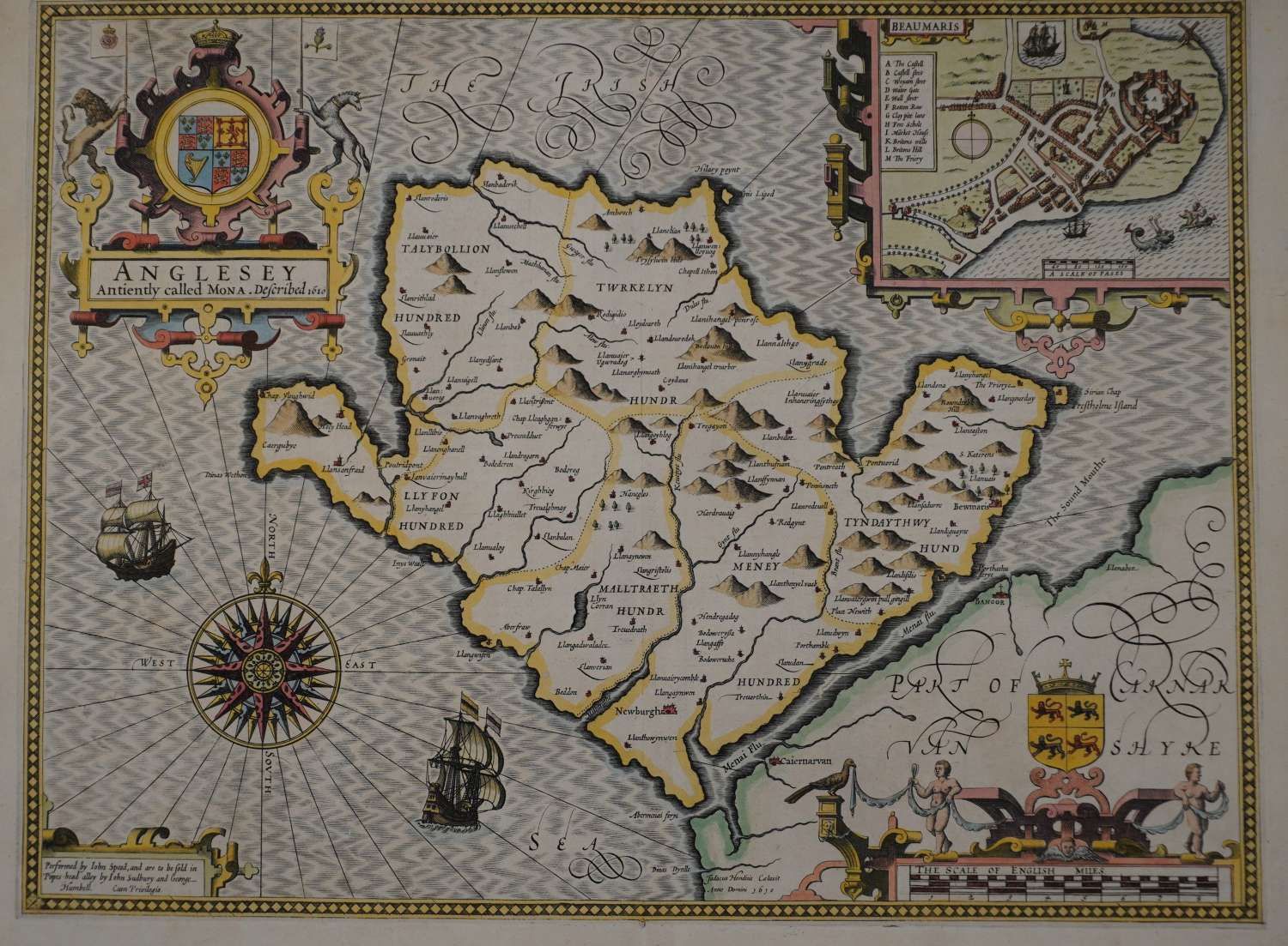
FIRST EDITION. Long title: Anglesey Antiently called Mona. Copper engraving; later hand colouring. Overall size : 54.1cms x 41.5cms. Image size : 505mm x 382mm. Compass rose, title in cartouche, inset town plan of Beaumaris with ‘scale of pases’ at bottom of the plan which is believed to indicate that John Speed himself mapped the town. .English text on verso describing the history, geography and other salient points about the county (Speed thought its air ‘reasonable, grateful and healthful’..;he was impressed that there were 333 ‘villages’ by which he meant scattered settlements marked and named on the map and 74 churches serving the religious needs of the island’ ). Edge tear repairs left and right margin on verso and 7 cms re-inforcement at top of centrefold on verso (not visible from the front) and tiny repair at bottom of centrefold on verso. Themap area itself is in very good condition and a good glossy impression as one would expect. Shot silk sea by Jodocus Hondius.
Unfortunately, there are no surviving records of how many examples of the First Edition (or indeed of any edition) of John Speed’s maps were printed. One might speculate that the First Edition could have numbered between about five hundred and one thousand examples. It should be remembered that market for maps was not well developed in England in 1612. This, together with the cost of the atlas, the need for a second edition soon afterwards, and the high quality of impressions from the third, Latin text, edition of 1616, suggests that the first print-run may have been closer to five hundred copies or so. Unfortunately, until an attempt is made at a census of surviving examples, these figures can be regarded as only the roughest of estimates. Ashley Baynton-Williams see http://www.mapforum.com/02/speed.htm
