Code: 53499
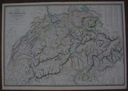
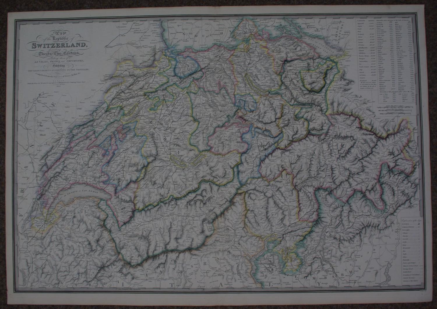
Long title Map of the Republic of Switzerland describing its twenty two cantons including those of le Valais, Geneva, and Neuchatel exibiting the various objects interesting to the traveller. Compiled from the Surveys of Weiss, Kellar &c. Steel engraving with original outline and colour denoting the regions . Overall sheet size: 84.9cms x 59.6cms; image size: 822mm x 554mm. Highly detailed map, finely engraved. Top right list of Cantons, altitudes above Lake Lucerne and three scale of miles. Explanation key bottom right detailing the symbols for cities, inns, ruins, bathes, mines, waterfalls etc Centrefold as issued. Very good condition.
Date:- 1829
James Wyld was apprenticed to William Faden , taking over the business in 1823 and becoming Geographer to His Majesty (George IV and William IV) and his maps were among the most excellent published in the Nineteenth Century. He enjoyed a very successful career but died early from overwork. His son continued and expanded the business having joined his father in the map trade at 18. He became Geographer to the Queen and H.R.H. Prince Albert and was M.P. for Bodmin from 1847-1852 and from 1857-1868. He was master of the Clothworkers Company and worked hard for the promotion of technical schools. Like his father he was held in high esteem and held no less than 17 European orders of merit. He died in 1887 in Kensington. His son James John Cooper Wyld (1845-1907) took over on his father's death but sold the family business to G.W. Bacon in 1892. (Tooley)