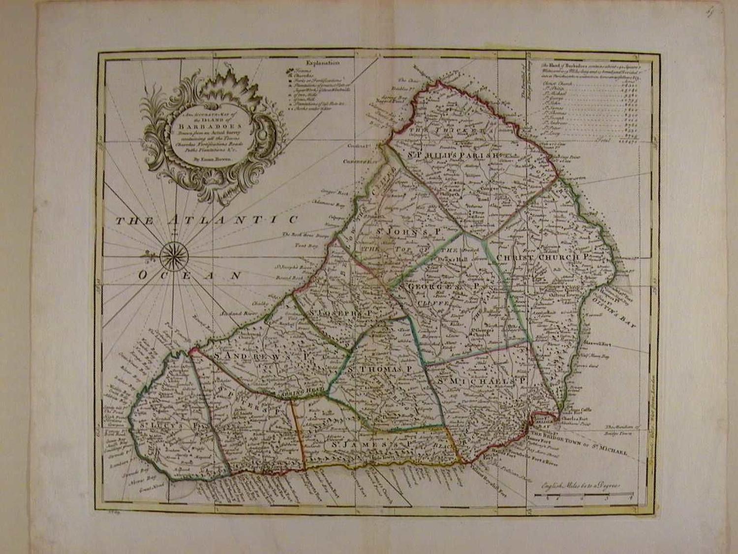
Code: 45588
Author: Emanuel Bowen
Date published: 1752
Uncommon thus.. Copper engraving with original outline hand colouring. Overall size: 53.1cms x 43.2cms; image size: 422mm x 352mm. Old ink number top right of sheet. Central crease as published, slightly toned and prominent; some marks in margin well away from image. Explanation key to the forts, sugar mills and plantations; key to the 11 Parishes. Beautifully engraved and very detailed map with compass rose and rhumb lines emanating from it in lovely, contemporary condition. Emanuel Bowen (1714-1767) was mapmaker to King George II and Louis XV (France), and his most distinguished work is the System of Geography from which this map came. His output was prolific and he produced several English county atlases, in some of which he was assisted by his son Thomas. Despite this commercial success ill-health and impecuniosity dogged both father and son, the latter dying in Clerkenwell Workhouse.
