Code: 54843
Date: 1753
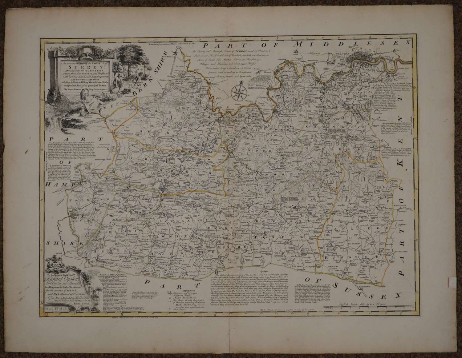
An Accurate Map of the County of Surrey Divided into its Hundreds, Drawn from late Surveys and Illustrated with various additional Improvements..., J, Tinney, 1753, engraved map with contemporary outline colouring, originally published in 'The Large English Alas', large uncoloured engraved cartouche and dedication, very slight spotting, short split at the base of the central fold, additional horizontal crease only noticeable by feeling the map. Overall sheet size : 84.3cms x 65.2; image size 530 x 720 mm. Small piece of paper stuck to margin edge right side but beautiful map in good condition with small London top right - Chelsea is far outside London here.
This map was produced for inclusion in the Large English Atlas which was the finest county atlas produced in the 18th.Century and was the largest scale atlas produced to date. Clearly engraved with panels of text in the areas surrounding each county describing the commerce and the state of the principal cities.
Hodson County Atlases of the British Isles vol II p 130 (h) Printed for R Wilkinson, Laurie & Whittle, and Bowles and Carver.
