
Code: 54842
Date: 1765 circa
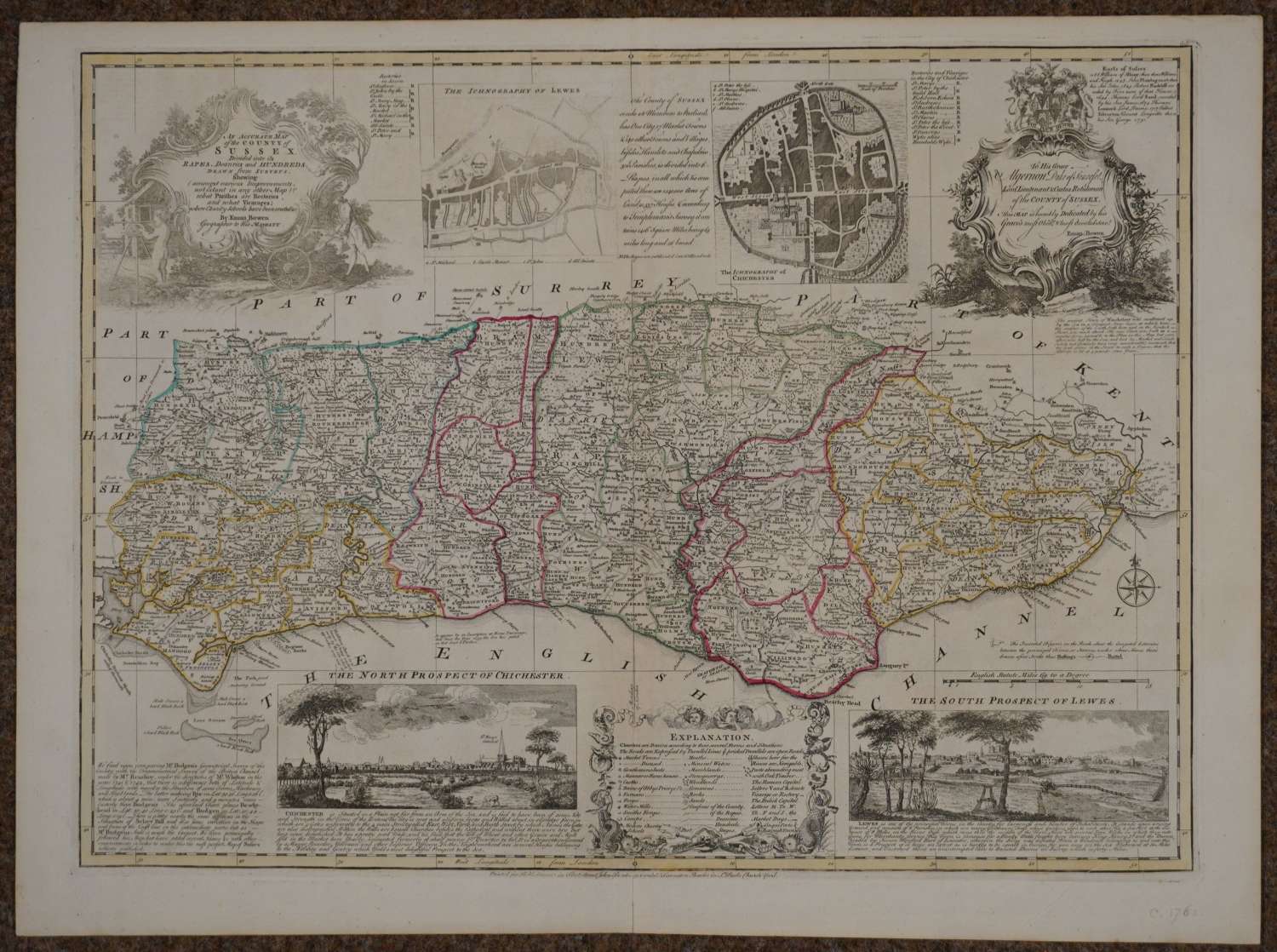
An Accurate Map of the County of Sussex Divided into its Rapes, Deanries and Hundreds, Drawn from Surveys..., John Sayer, Robert & Carington Bowles, circa 1765, engraved map with contemporary outline colouring, originally published in 'The Large English Atlas', inset panoramas of the north prospect of Chichester and the south prospect of Lewes, inset ichnography of Chichester and Lewes, large decorative uncoloured cartouche and dedication. Overall sheet size : 76.6cms x 56.9cms ; image size: 515 x 690 mm. Very small repair to bottom of centrefold of large margin on verso else very good condition. Stunning map.
This map was produced for inclusion in the Large English Atlas which was the finest county atlas produced in the 18th.Century and was the largest scale atlas produced to date. Clearly engraved with panels of text in the areas surrounding each county describing the commerce and the state of the principal cities.
Hodson County Atlases of the British Isles vol II p 130 (h) Printed for R Wilkinson, Laurie & Whittle, and Bowles and Carver.
