
Code: 55495
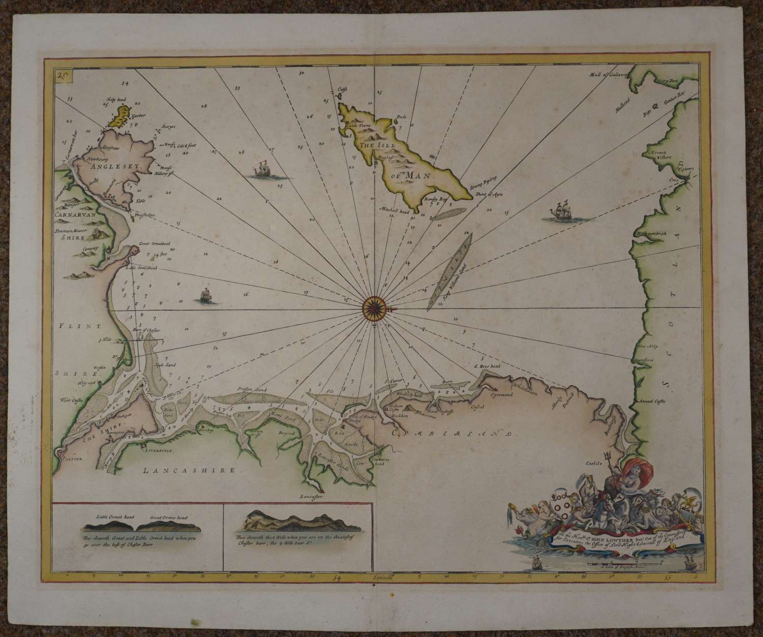
562mm x 442mm. Dedication reads: To the Honble Sr John Lowther Bart. One of the Commissioners/ for Executing the Office of Lord High Admirall of England.Dedication in bottom right corner in a frame surmounted by Neptune rising from the water in his chariot with cherubs to right and left holding arms. The scale is below this cartouche. In the bottom left corner is a panel of 26.9cms by 5.7 cms containing two profiles. Blank back. Manuscript in the Hydrographic Department in Taunton (B. 894) Good strong impression and attractive later but not recent hand colouring, overall toning and some speckling in Scotland and right hand blank area; yellow line outside neat line from old framing; remnants of tape on top margin on verso; very slight abrasion below ship top left else good strong impression of a very interesting area (Anglesea, N Wales, Liverpoole to Wigtown and Mull) in very good condition.
Date:- 1750
The Reign of Charles II was interspersed with wars against the Dutch, principally fought on the high seas. It was soon realised that the Dutch navy had access to better sea charts of English waters than the English themselves. Accordingly, in 1681 Charles II commissioned Captain Greenville Collins to make a survey of the coasts of Great Britain, a task accomplished between 1681 and 1687. During this survey Collins completed 120 manuscript draughts, of which forty-seven were engraved for the Coasting Pilot. The commission was to ’make a survey of the sea coastes of the Kingdom by measuring all the sea coast with a chain and taking all the bearings of the headlands with their exact latitude’. Collins surveyed the whole of the Welsh coastline for the first time in a vessel called Merlin. Several sea charts were published separately prior to the publication of Great Britain’s Coasting Pilot in 1693. The charts were finely engraved and showed coastal features, soundings, shoals, anchorages and rocks in detailed but contained latitudes and longitudes only on the chart of the whole of Wales.
The surveying took seven years and then engraving the charts took five years. Samuel Pepys wrote;’It will be necessary that before even Collin’s work be published the Trinity House do send some of their members or others to make a review of all that he has done, thereby either to correct or confirm it’.
The engraving was carried out by some of the leading practitioners of the art, principally John Harris Sr and Herman Moll with James Collins and Nicholas Yeates engraving most of the cartouches..see Wardington Library Sale Catalogue
