Code: 54260
Date: Circa 1769
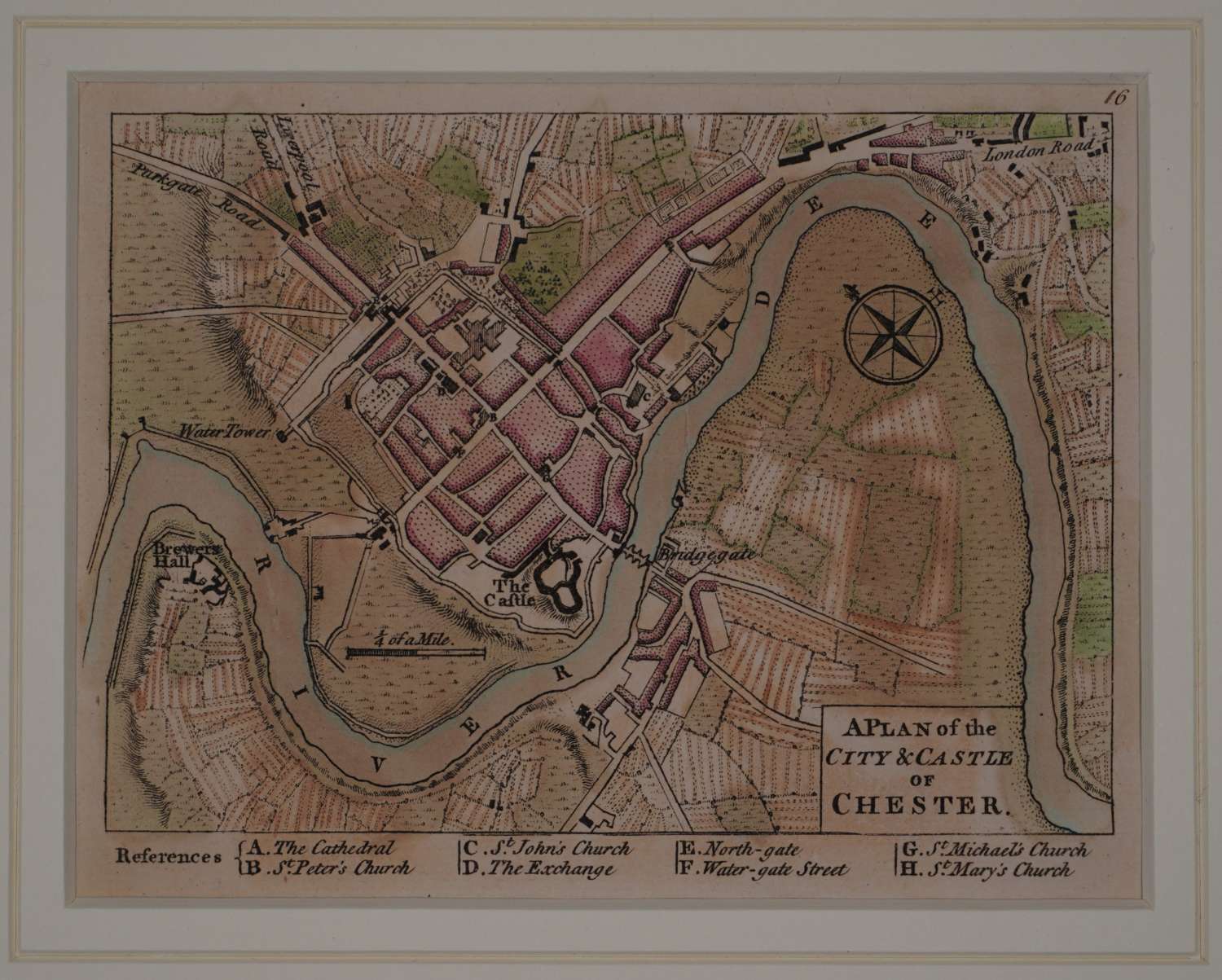
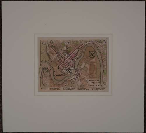
Copper engraving with early hand colouring. A charming miniature, one of the few 18th Century plans of Chester. It features an eight point key below the town plan of the most important buildings It was published in Dury's rare pocket atlas, 'A Collection of Plans of the Principal Cities of Great Britain & Ireland, with Maps of the Coast of the Said Kingdoms, Drawn from the most Accurate Surveys, In Particular those taken by the late Mr. J. Rocque, Topographer to His Majesty'. This was designed as a companion to Dury's 'Universal Pocket Atlas’. Overall size in off white conservation grade mount and back with decorative v groove : 282mm x 258mm; image size: 134mm x 103mm. Very good condition.
