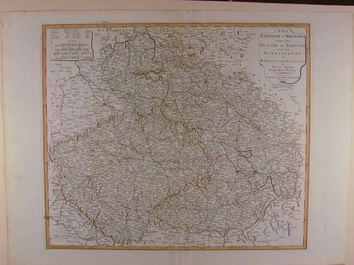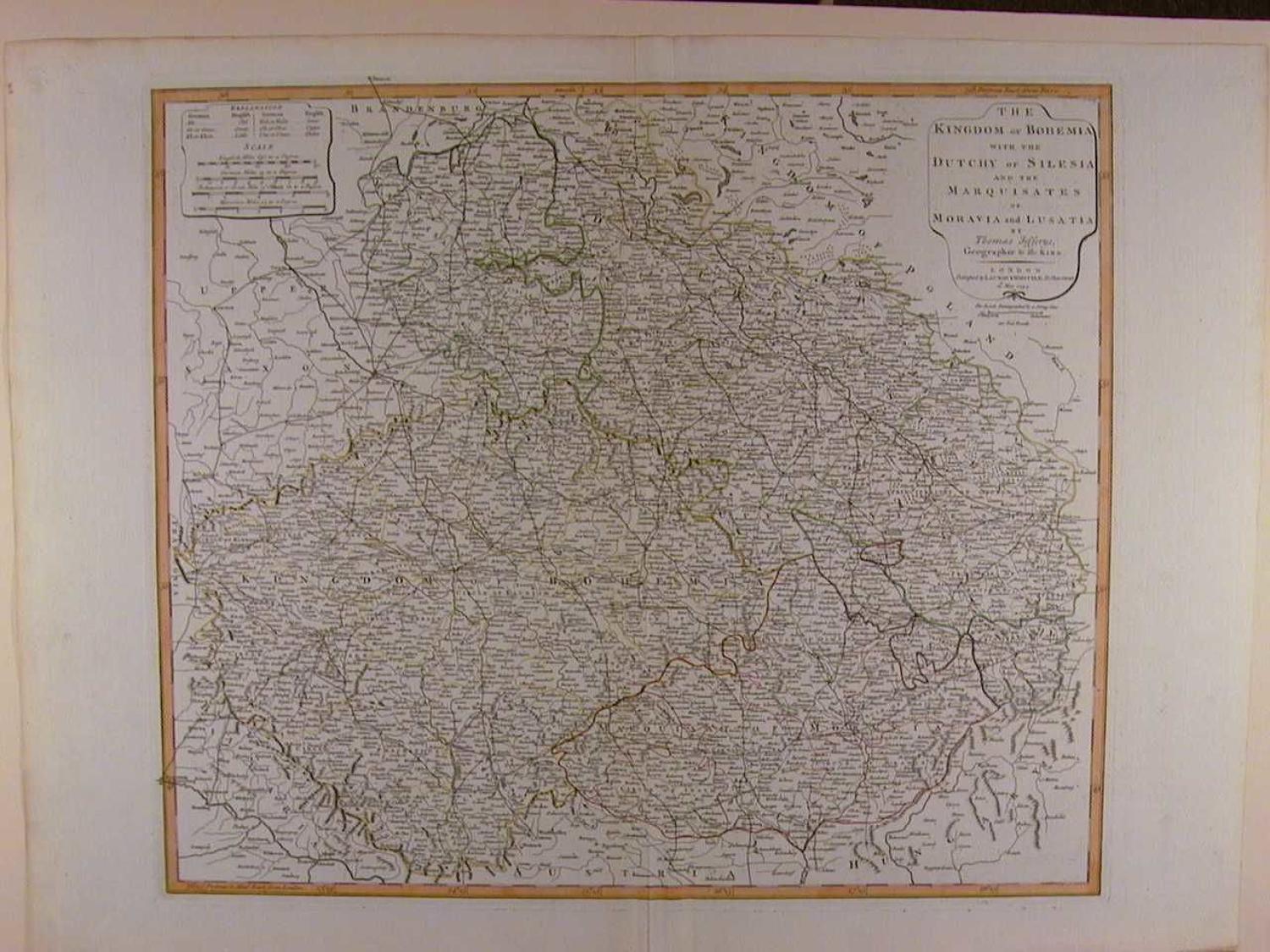
Code: 49346
Author: Thomas Jefferys
Publisher: Laurie and Whittle
Date published: 1794
Copper engraving with original outline hand colouring. Overall size unmounted : 73.2cms x 54.9cms. Image size : 561mm x 480mm.approx. This is a very detailed map covering eastern Germany, the Czech Republic, and western Poland. The map provides information on the topography, cities and towns, roads, postal routes, rivers and forests. Very good condition apart from a little browning, chipping and curling at extreme bottom right margin edge. Highly detailed, finely engraved map.