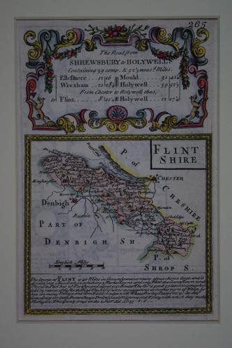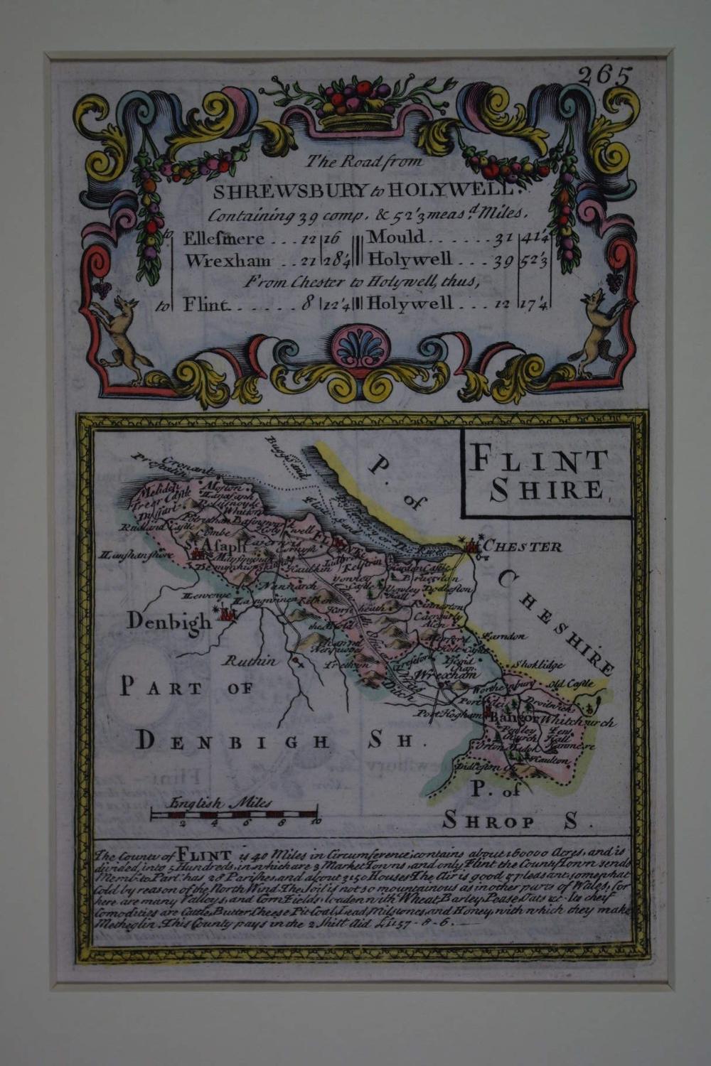
Code: 50413
Author: Owen, John & Bowen, Emanuel
Publisher: Britannia Depicta
Date published: 1720circa
County Map. Copper engraving with later hand colouring. Overall size in hinged off white fully conservation mount and back (so floating freely apart from two pieces of archival tape) : 26.8cms x 34.2cms. Engraved size : 113mm x 183mm. Description of county below map..contains about 3150 houses for example and that :The air is good and pleasant, somewhat cold due to the North wind..Its chief Commodoties are Cattle, Butter, Cheese, Pit coal, Lead, Milstones and honey.The verso (uncoloured) has the road from Shrewsbury to Wrexham (266). Very good condition apart from some faint show through from verso. Emanuel Bowen, in collaboration with John Owen, engraved the maps for the half-scale reduction of Ogilby's road maps of 1675. The need for a smaller version to take on coach travel was supplied by their Britannia Depicta and was first published in 1720 : The Whole for its Compendious Variety & Exactness, preferable to all other Books of Roads hitherto Published or Proposed ; And calculated not only for the direction of the Traveller (as they are) but the general use of the Gentleman and Tradesman. This set of maps was very popular and had many re-issues and was probably the most successful of the pocket road maps combining as it did individual county maps followed by a set of strip road maps.