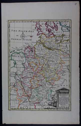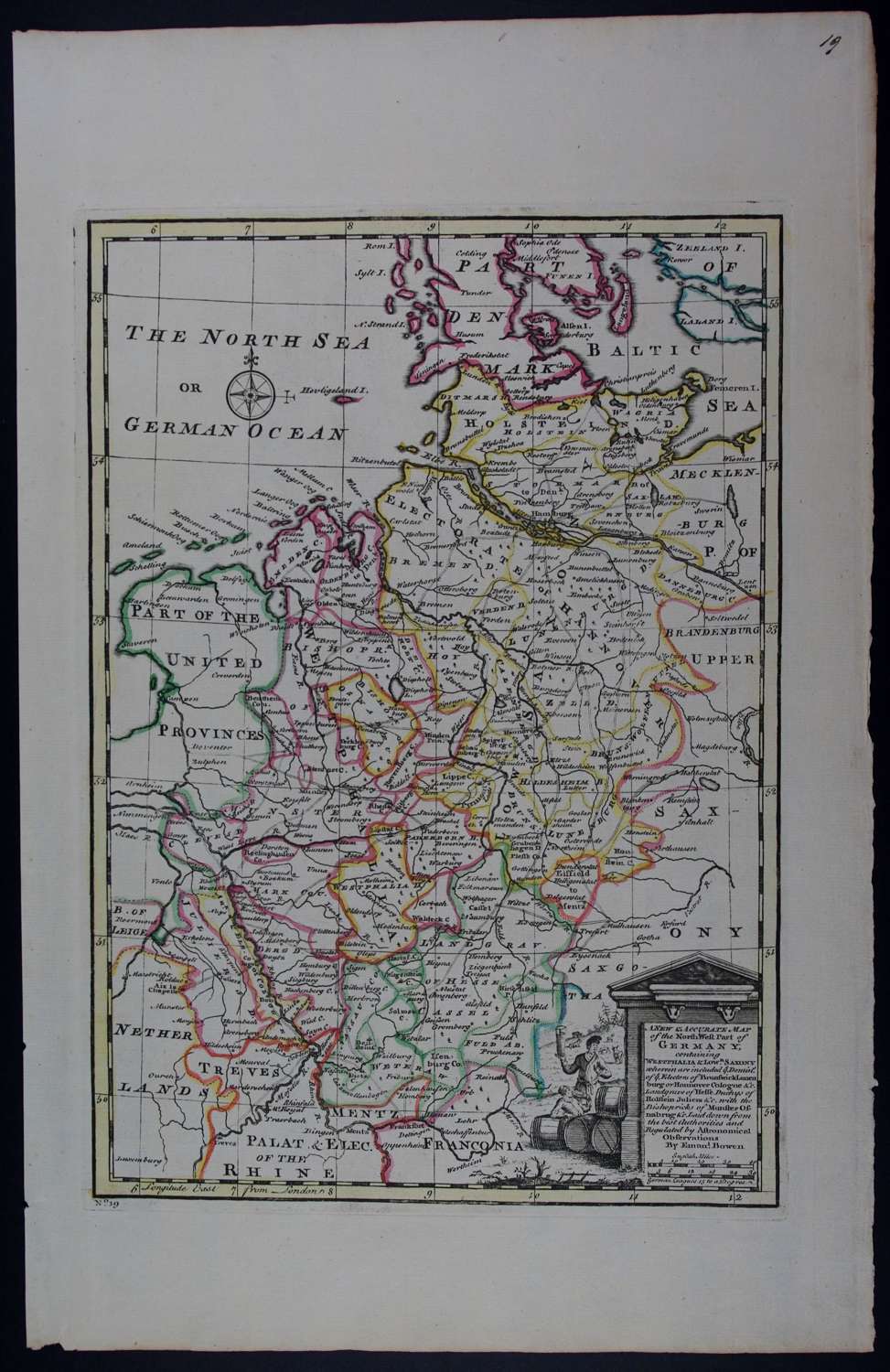
Code: 45570
Author: Emanuel Bowen
Date published: 1752
Uncommon thus.. Copper engraving with original outline hand colouring. Overall size: 27.5cms x 43.2cms. Image size: 222mm x 321mm. Highly decorative title cartouche Old ink number top right, Odd mark to margins else lovely condition. Emanuel Bowen (1714-1767) was mapmaker to King George II and Louis XV (France), and his most distinguished work is the System of Geography from which this map came. His output was prolific and he produced several English county atlases, in some of which he was assisted by his son Thomas. Despite this commercial success ill-health and impecuniosity dogged both father and son, the latter dying in Clerkenwell Workhouse.