
Code: 55493
Date: 1640 Circa
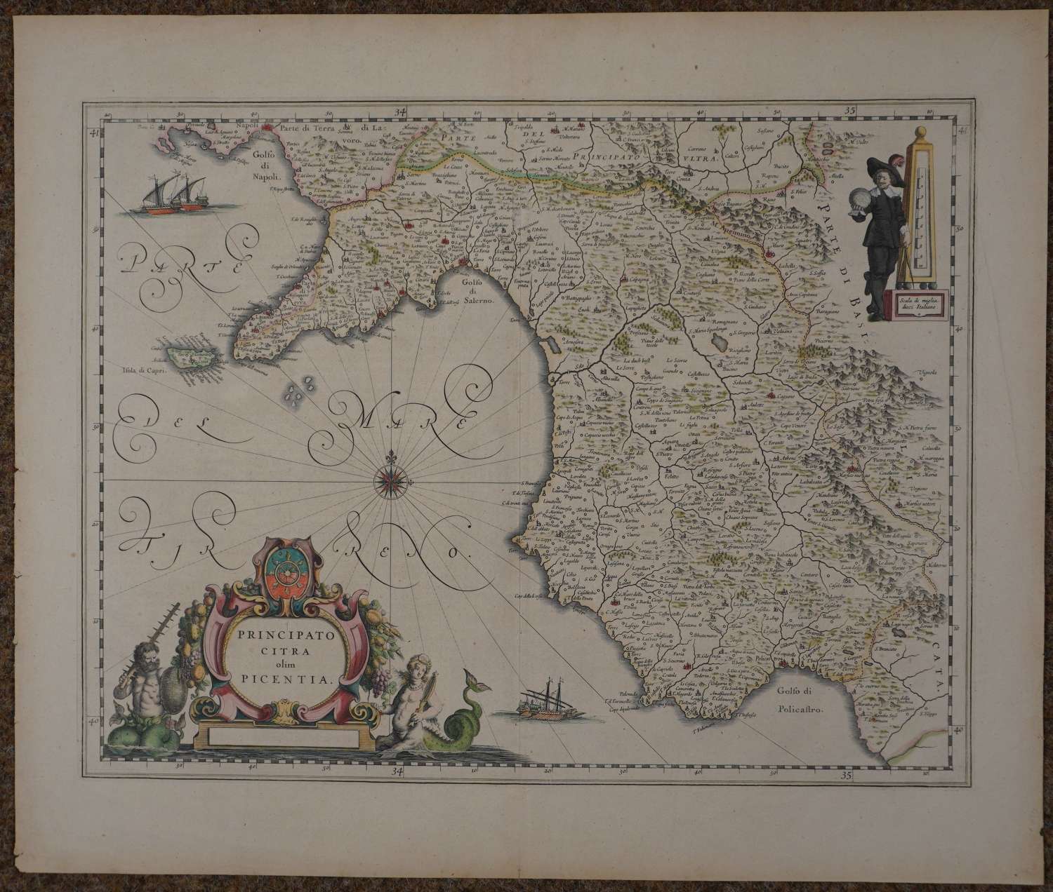
Copper engraving with original hand colouring . French text verso pp103. Overall sheet size : 57.2cms x 48.3cms ; image size: 498mm x 383mm. This is a detailed map which shows the Amalfi coast of Campagnia in Italy between Naples and Basilicata and also shows the Isle of Capri. Two very beautiful cartouches. One enclosing the scale of miles showing a surveyor with dividers, globe in hand. The title cartouche features fruit and ears of corn signifying plenty and a mermaid and merman (complete with razor fish sword and turtle shell) ; compass rose and swash lettering in the sea. Some margin nicks and slight overall toning else stunning map in very good condition.
"As with all productions of the firm of Blaeu, the engraving and layout are all of the highest standard." Rodney Shirley.
Willem Janszoon Blaeu (1571-1638) was a prominent Dutch geographer and publisher. The son of a herring merchant, Blaeu studied mathematics and astronomy . He studied instrument and globe making with the Danish astronomer Tycho Brahe. Blaeu set up shop in Amsterdam, where he sold instruments and globes, published maps. In 1635, he released his atlas, Theatrum Orbis Terrarum, sive, Atlas novus.
Willem died in 1638. He had two sons, Cornelis (1610-1648) and Johannes (1596-1673). Joan trained as a lawyer, but then joined his father’s business. After his father’s death, the brothers took over their father’s shop and Johannes took on his work as hydrographer to the Dutch East India Company. Later in life, Johannes would modify and greatly expand his father’s Atlas Novus, eventually releasing his masterpiece, the Atlas Maior, between 1662 and 1672.
