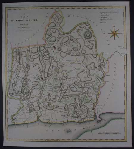
Code: 53726
Date 1809
Copper engraving, original and later hand colouring.. Overall size : 43.9cms x 48.4cms. Image size : 403mm.x 450mm. Good margins. Old folds as issued. Re margined left margin with old paper to facilitate mounting and framing and re-instatment of black line else very good condition.
John Cary and his brother William were active globe-makers in London though John Cary was also an engraver and publisher and came to be regarded as one of the leading English cartographers. In 1787 Cary published his ‘New and Correct English Atlas’. Although lacking in the type of decoration characteristic of earlier mapmakers they are nevertheless elegant in their clarity and finely engraved detail. This atlas proved to be very popular and many editions were published, the final one being in 1862. In 1789 Cary published a pocket atlas entitled ‘Cary’s Travelling Companion’ which was also a success and in 1794 Cary was employed by the Postmaster-General to undertake a survey of all the main roads in the country.