
Code: 56175
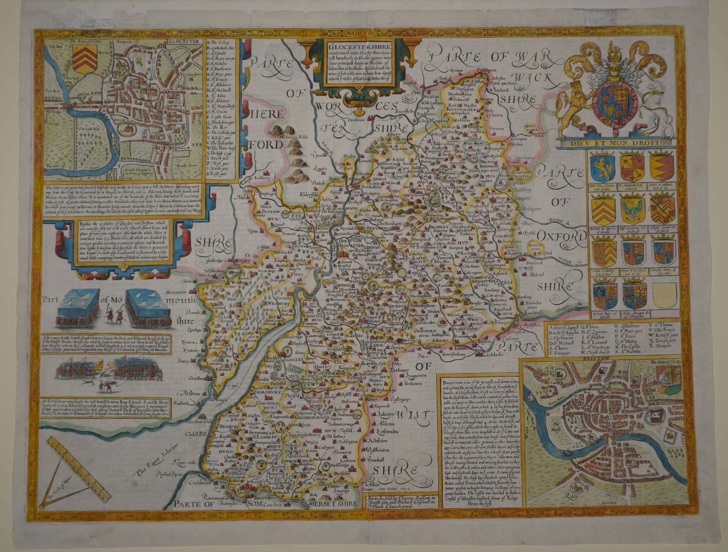
Copper engraving, later but not recent hand colouring. Overall sheet size: 53.8cms x 42.4cms. Image size: 512mm x 382mm. 11 armorials and one blank shield top right below the royal coat of arms; plan of Bristol (Bristow) and history thereof bottom right and plan of Glocester top left; two battlescenes and historical text on left and , in extreme left corner, scale of distance balanced on dividers. 5cms strengthening top of centrrefold on verso and 1.5strengthening bottom margin; edge tears left margin repaired on verso; damaged and split top margin strengthened and augmented by re-margining underneath with old paper. English text on verso. Well coloured and a good impression.
Until his late thirties, John Speed was a tailor by trade but his passion for history and map-making led him to gain a patron in Sir Fulke Greville, the poet and statesman, who found him a post in the customs and helped subsidize his map-making, giving him “full liberty to express the inclination of my mind”. He became aquainted with the publisher William Camden, whose descriptive text was used by Speed for most of the maps in his atlas “The Theatre of Empire of Great Britain” published most probably in 1612 although it bears the date 1611 on the main title page. The maps were engraved in Amsterdam by Jodocus Hondius, one of the foremost engravers of his time. Speed’s maps are unique historical documents of their time and the town plans featured on the maps are in most cases the first information we have of their early apppearance. Their artistry has guaranteed the collectability of these maps in the centuries that have followed.
