Code: 53658
Date:1707
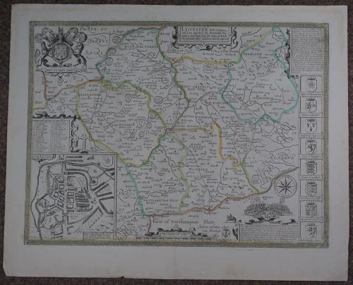
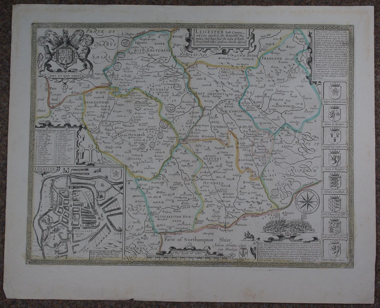
Copper engraving with later hand colouring. Overall sheet size: 56.6cms x 45.6cms. Image size: 500mm x 375mm. Town plan of Leicester with key to the 34 chiefe place of the Citie above; royal coat of arms and 8 coats of arms below a brief history of the Countie and adjacent to a depiction of the battle of Bosworth : the last battail betwixt the familyes of York and Lancaster was fought (it being the climatic battle of the Wars of the Roses in 1485). Henry Overton edition showing the roads; ORIGINAL hand colouring outlining the hundreds. Little speckling to marginand some edge nicks else very good condition.
Until his late thirties, John Speed was a tailor by trade but his passion for history and map-making led him to gain a patron in Sir Fulke Greville, the poet and statesman, who found him a post in the customs and helped subsidize his map-making, giving him “full liberty to express the inclination of my mind”. He became aquainted with the publisher William Camden, whose descriptive text was used by Speed for most of the maps in his atlas “The Theatre of Empire of Great Britain” published most probably in 1612 although it bears the date 1611 on the main title page. The maps were engraved in Amsterdam by Jodocus Hondius, one of the foremost engravers of his time. Speed’s maps are unique historical documents of their time and the town plans featured on the maps are in most cases the first information we have of their early apppearance. Their artistry has guaranteed the collectability of these maps in the centuries that have followed.
7