Code: 54235
Date: 1616
Latin edition which is considered to be the rarest. Engraved by Jodocus Hondius with his signature hatching in the sea . Copper engraving with original hand colouring. Overall size : 53.3cms x 40.3cms. Image size : 508mm x 381mm. Latin text on verso. . One pinprick top of map at centrefold (often the case with first editions and thought to be a direction to the binder) and a small area of thinness in text under portraits observable only when held up to the light and barely worth mentioning.
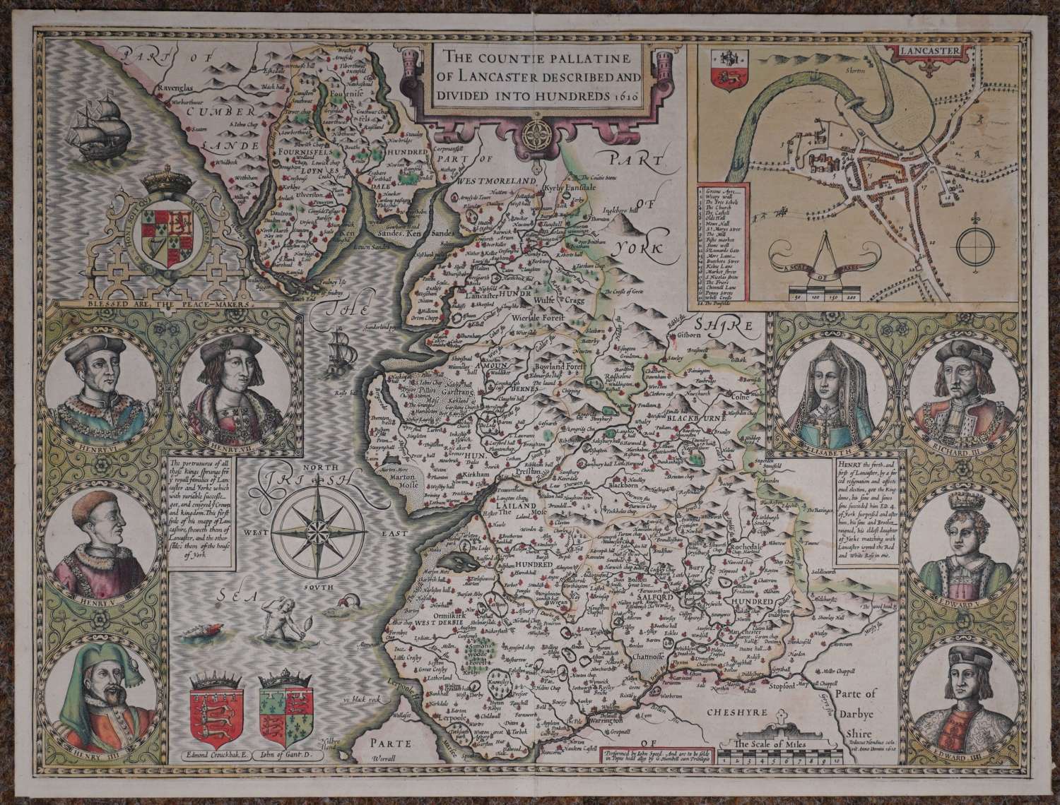
Although most of the detail of Speed's map is copied from Saxton, Whitaker writes that this was the first map of Lancashire to show the hundreds, and that the inset was probably the first printed town plan of Lancaster (copied by Braun and Hogenberg in 1618). On the left side of the map are four portraits of Lancastrian kings (Henrys IV to VII); on the right are three Yorkish Kings (Richard III and Edwards IV & V) and a portrait of Elizabeth, who united the families by marrying Henry VII. A mermaid preens herself in the sea in between two monsters. WHITAKER: 41. Chubb XX . Skelton7
Until his late thirties, John Speed was a tailor by trade but his passion for history and map-making led him to gain a patron in Sir Fulke Greville, the poet and statesman, who found him a post in the customs and helped subsidize his map-making, giving him “full liberty to express the inclination of my mind”. He became aquainted with the publisher William Camden, whose descriptive text was used by Speed for most of the maps in his atlas “The Theatre of Empire of Great Britain” published most probably in 1612 although it bears the date 1611 on the main title page. The maps were engraved in Amsterdam by Jodocus Hondius, one of the foremost engravers of his time. Speed’s maps are unique historical documents of their time and the town plans featured on the maps are in most cases the first information we have of their early apppearance. Their artistry has guaranteed the collectability of these maps in the centuries that have followed.
