
Code: 56145
Date: 1814
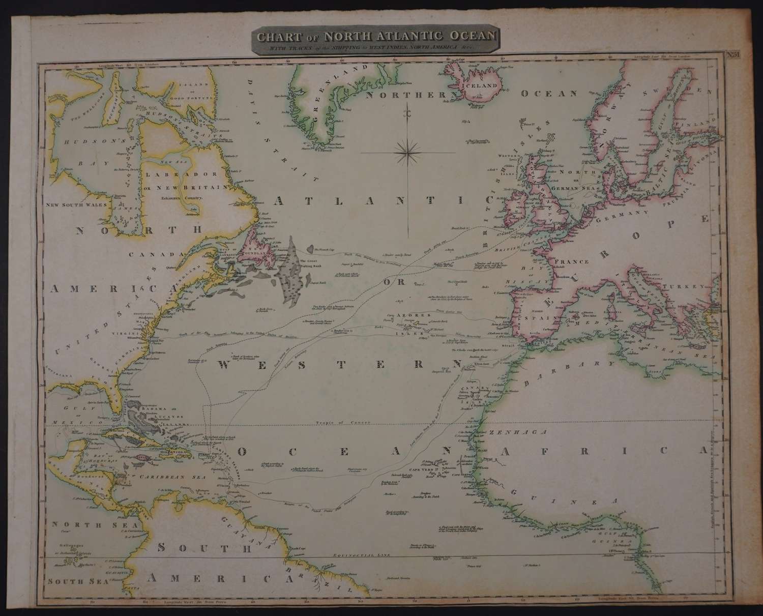
Long title: Chart of North Atlantic Ocean with tracks of the shipping to West Indies, North America etc Copper engraving by John Moffat with wash original hand colouring to the sea with outline to the land masses. Overall sheet size: 68.5cms x 54.3cms ; image size: 635mm x 528mm. Fascinating map with many interesting notes and the tracks of Lord Nelson to the West Indies in Pursuit of the French 1805, track of United States Ship Insurgent from America to the Canary Islands and general trade shipping routes are also marked .
Some light toning and foxing in blank areas -not offensive or obtrusive. Thread margin at the bottom. Fascinating map.
John Thomson was one of the leading exponents of the Edinburgh school of cartography which reached its zenith between 1800 and 1830. Thomson & his contemporaries such as Pinkerton and Cary redefined European cartography by abandoning such 18th century decorative elements as elaborate title cartouches and fantastic beasts in favour of detail and accuracy. Thomson’s principle works include the Thomson’s New General Atlas published from 1814 though 1827 (from which this map originates) and his Atlas of Scotland. The Atlas of Scotland, a work of groundbreaking detail and dedication would eventually bankrupt the Thomson firm in 1830. His maps are prized today for the quality of their detail, their size and the attractiveness of the original colouring.