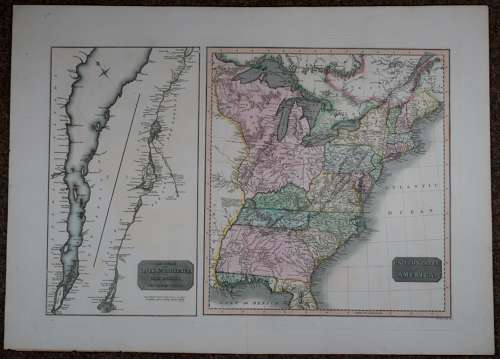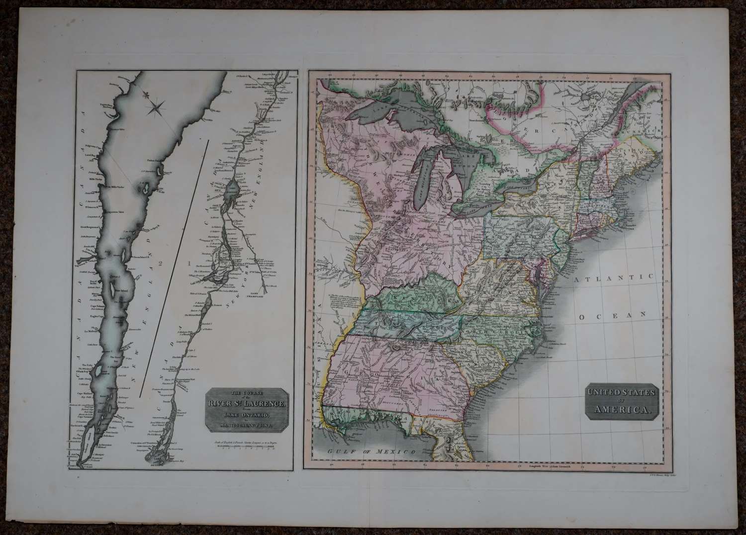
Code: 54513
Date: 1821
Detailed early map of the United States with a second map showing the St. Lawrence. Copper engraving with original full wash original hand colouring. Overall sheet size: 74 cms x 53.2cms; image size: 613mm x 411mm , engraved by J. & G. Menzies. Very good condition indeed.
The map of the United States extends west to just beyond the Mississippi and features many early transitional borders. Georgia still extends to the Mississippi. Ohio is not yet shown, with the entire old Northwest Territory simply called The Western Territory ( It includes today's Minnesota, Wisconsin, Michigan, Illinois, Indiana, and Ohio.). Many Indian names noted throughout Georgia and the Western Territory. West Florida still extends to the Mississippi River. Dozens of forts shown in the west. Fascinating details noted such as:’here the Mississipi is half a mile wide’ and ‘Island and Meadow remarkable for Wild Fowl’. The map of the St. Lawrence includes well over 100 place names.