
Code: 55482
Date: Circa 1620
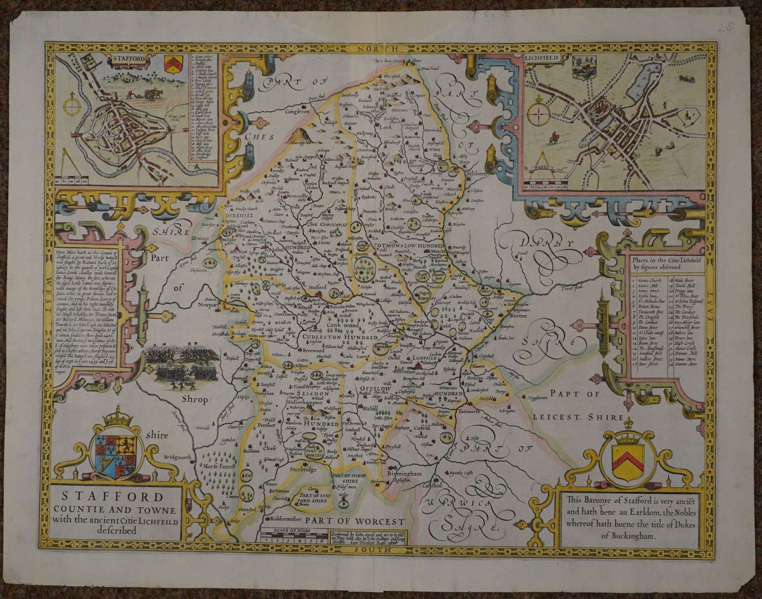
Copper engraving, later hand colouring. Overall size : 52.3cms.x 40cms. Image size : 500mm.x 377mm. Title in cartouche surmounted by arms and crown. Two town plans of Lichfield and Stafford top left and right.
Rare BLANK back so no show through to spoil the aesthetic pleasure of the map. Possibly this map was never in an atlas and for sale in a pile in a print shop..One area of weakness to the left of the bottom right cartouche , one edge tear to top margin else good strong impression in very good condition.
Until his late thirties, John Speed was a tailor by trade but his passion for history and map-making led him to gain a patron in Sir Fulke Greville, the poet and statesman, who found him a post in the customs and helped subsidize his map-making, giving him “full liberty to express the inclination of my mind”. He became aquainted with the publisher William Camden, whose descriptive text was used by Speed for most of the maps in his atlas “The Theatre of Empire of Great Britain” published most probably in 1612 although it bears the date 1611 on the main title page. The maps were engraved in Amsterdam by Jodocus Hondius, one of the foremost engravers of his time. Speed’s maps are unique historical documents of their time and the town plans featured on the maps are in most cases the first information we have of their early appearance. Their artistry has guaranteed the collectability of these maps in the centuries that have followed.`
