
Code: 54864
Date: circa 1680
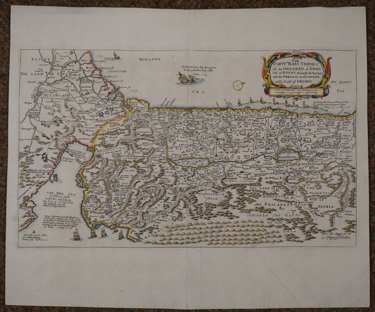
Copper engraved map with later hand colouring. The west is oriented to the top, title within cartouche. The map is filled with notations and biblical references and embellished with tiny vignettes including ships, Jonah and the whale, and a decorative cartouche incorporating a scale of English miles (each containing 1000 paces). The map shows the forty years of travel that the Israelites undertook seeking the Land of Promise as described in Exodus,chapters 1-12. Old repair on verso to long tear from bottom margin but just touching the mountains bottom right just inside the map else very good condition.
Richard Blome (1635-1705) was a bookseller, mapseller and publisher. He was also cosmographical Printer to King William III and Cosmographer to Queen Anne. He worked with the engraver Wenceslaus Hollar and produced,'A geographical description of the four parts of the world 1670 which is the first folio world atlas wholly engraved, printed and published in the British Isles. Hollar, together with Richard Palmer also engraved the maps in the Britannia. Blome was granted a royal privilege by Charles II in 1669 giving him copyright protection over his books of geography for twenty-one years, ' to encourage and enable him to finish this his commendable design'. He was one of the pioneers of financing publications by advance subscription, inserting the arms of his patrons on the maps and plates. His career casts light on the difficulties inherent in map-making in the latter part of the seventeenth century. See http://www.mapforum.com/09/9blome.htm and also British Map Engravers Laurence Worms and Ashley Baynton-Williams.