
Code: 56172
Date: 1614 2nd edition
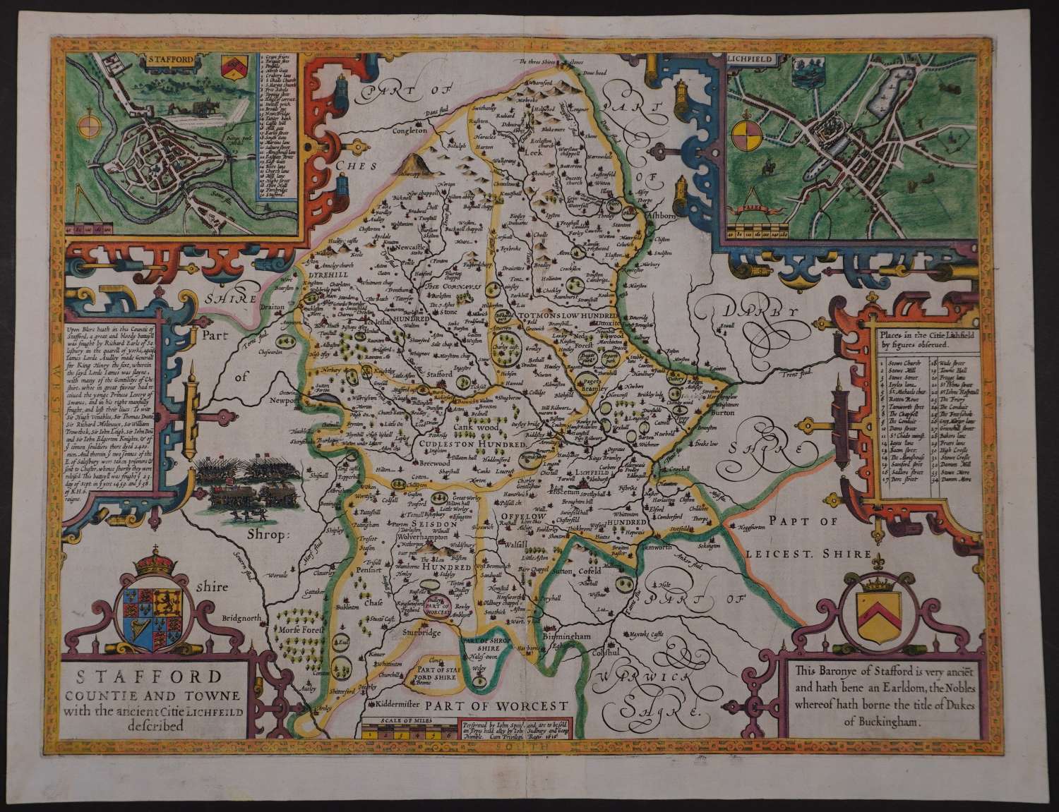
Second EDITION. Copper engraving with later hand colouring. Long title: Stafford Countie and Towne with the ancient Citie Lichfeild described. Overall size: 53.8cms x 41.5cms. Image size: 499mm x 380 mm.
Two town plans, of Lichfield right with key below (Pases are mentioned in a banner on the map divider on the scale of distance which is believed to indicate that Speed mapped the town himself) and a town plan of Stafford top left . Description of a great battle fought in Henry VI’s time which the huge numbers killed enumerated. English text verso describing the history and geography of Staffordshire. Repair to split in bottom of centrefold 11.5 cms; odd mark to margins and a little blotchiness to the town plans else good strong impression in good condition.
Until his late thirties, John Speed was a tailor by trade but his passion for history and map-making led him to gain a patron in Sir Fulke Greville, the poet and statesman, who found him a post in the customs and helped subsidize his map-making, giving him “full liberty to express the inclination of my mind”. He became aquainted with the publisher William Camden, whose descriptive text was used by Speed for most of the maps in his atlas “The Theatre of Empire of Great Britain” published most probably in 1612 although it bears the date 1611 on the main title page. The maps were engraved in Amsterdam by Jodocus Hondius, one of the foremost engravers of his time. Speed’s maps are unique historical documents of their time and the town plans featured on the maps are in most cases the first information we have of their early appearance. Their artistry has guaranteed the collectability of these maps in the centuries that have followed.`
