Code: 54159
Date: 1855
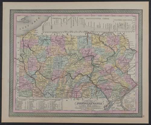
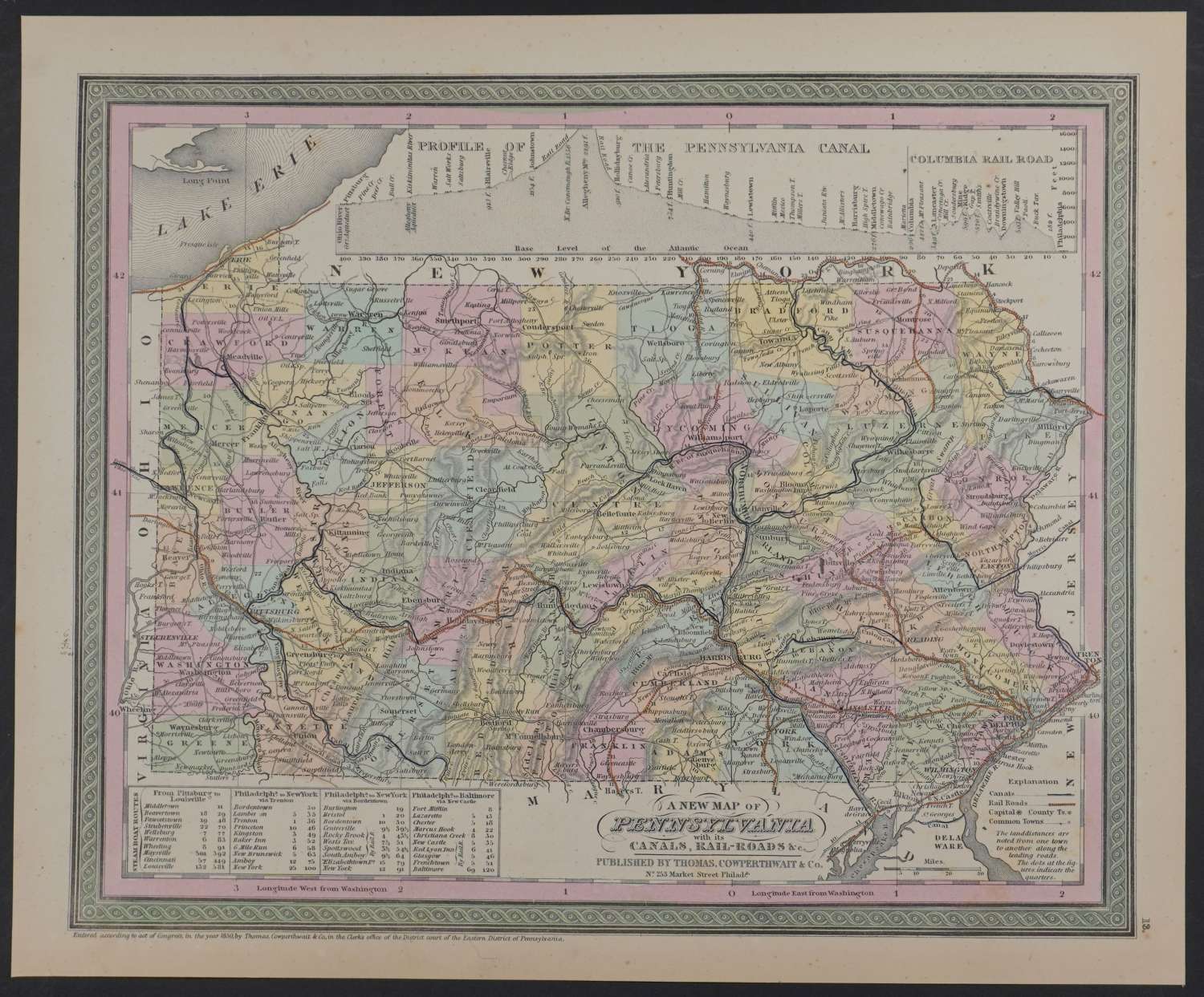
Published 1855 in Pennsylvania, dated 1850 . Lithograph with original full wash hand colouring. Overall sheet size: 40.1cms x 33.2cms; image size: 364mm x 298mm. Characteristic green decorative border and pastel colouring. Railroads marked in orange. Steam boat route in box bottom left; Explanation key bottom right . Profile of the Pennsylvania Canal and Columbia Rail Road at top of map. Browning to sheet edges else very good condition.
Thomas, Cowperthwait & Co. were a publishing company based in Philadelphia. They were part of the burgeoning atlas and map publishing in the early to mid-nineteenth century. They published many famous works, including Tanner’s New Universal Atlas. Their maps are notable for the decorative borders and fine, vivid original hand colouring.