Code: 4266
Date: 1855
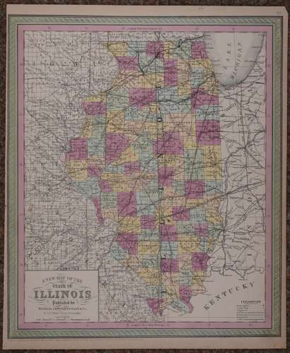
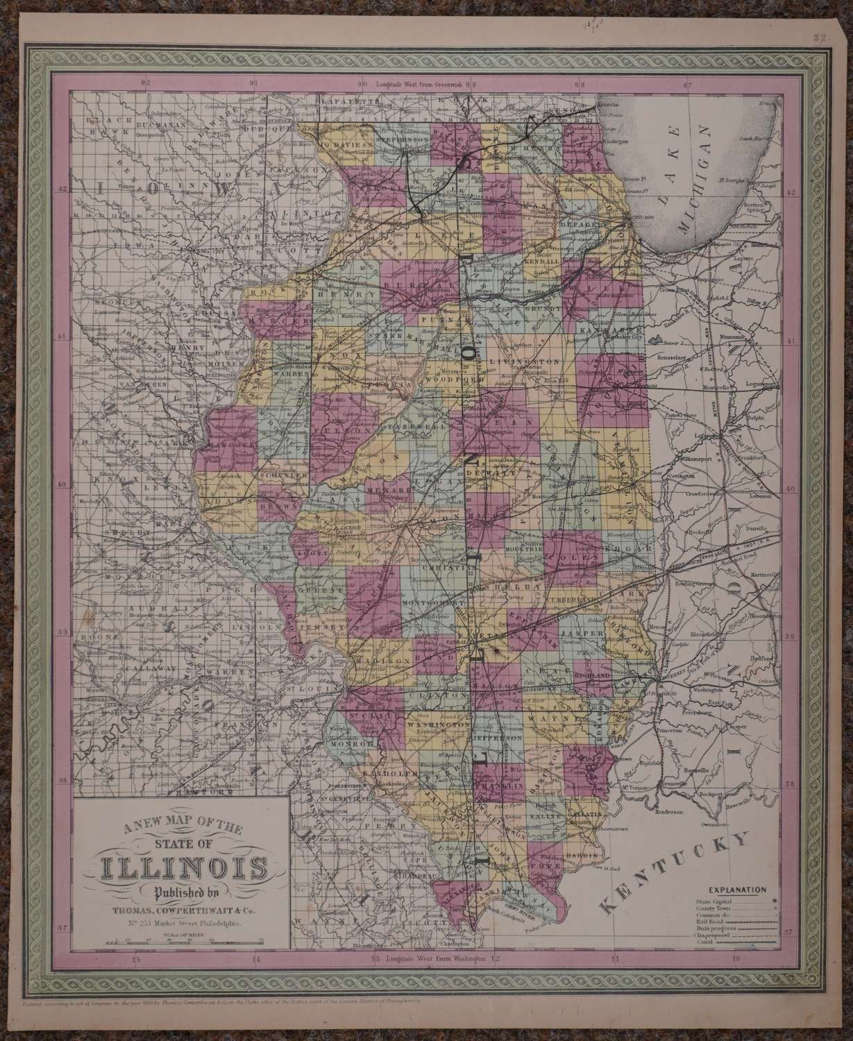
Published 1855 in Pennsylvania, dated 1850 . Lithograph with original full wash hand colouring; hand coloured by county. Overall sheet size: 34.8cms x 42.6cms; image size: 337mm x 401mm. Characteristic green decorative border and pastel colouring. Explanation Key bottom right showing symbols for canals , Rail Roads, Leading Roads, County Towns etc . Top right margin tip missing ; edges browned else very good condition.
Thomas, Cowperthwait & Co. were a publishing company based in Philadelphia. They were part of the burgeoning atlas and map publishing in the early to mid-nineteenth century. They published many famous works, including Tanner’s New Universal Atlas. Their maps are notable for the decorative borders and fine, vivid original hand colouring.