
Code: 54156
Date: 1855
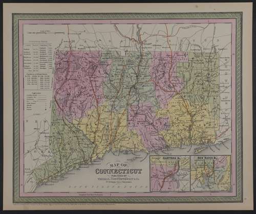
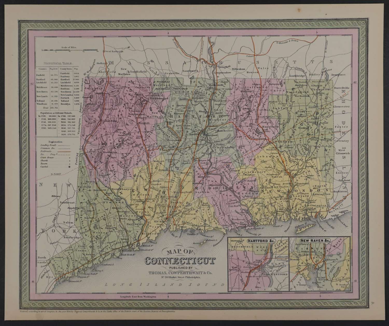
Published 1855 in Pennsylvania, dated 1850 . Lithograph with original full wash hand colouring. Overall sheet size: 41cms x 34.1cms; image size: 379mm x 320mm. Characteristic green decorative border and pastel colouring. Top left is a chart showing population tables by county. Inset of Harford etc and New Haven etc at bottom right. Railroads marked in orange (key mid left blank) . Detailed, clear and beautifully coloured map in very good condition apart from toning to margins and two spots in margins.
Thomas, Cowperthwait & Co. were a publishing company based in Philadelphia. They were part of the burgeoning atlas and map publishing in the early to mid-nineteenth century. They published many famous works, including Tanner’s New Universal Atlas. Their maps are notable for the decorative borders and fine, vivid original hand colouring.