Mostlymaps |
Tel: +44 (0)1497 820539 Email: info@mostlymaps.com Web site: https://www.mostlymaps.com/ |
|
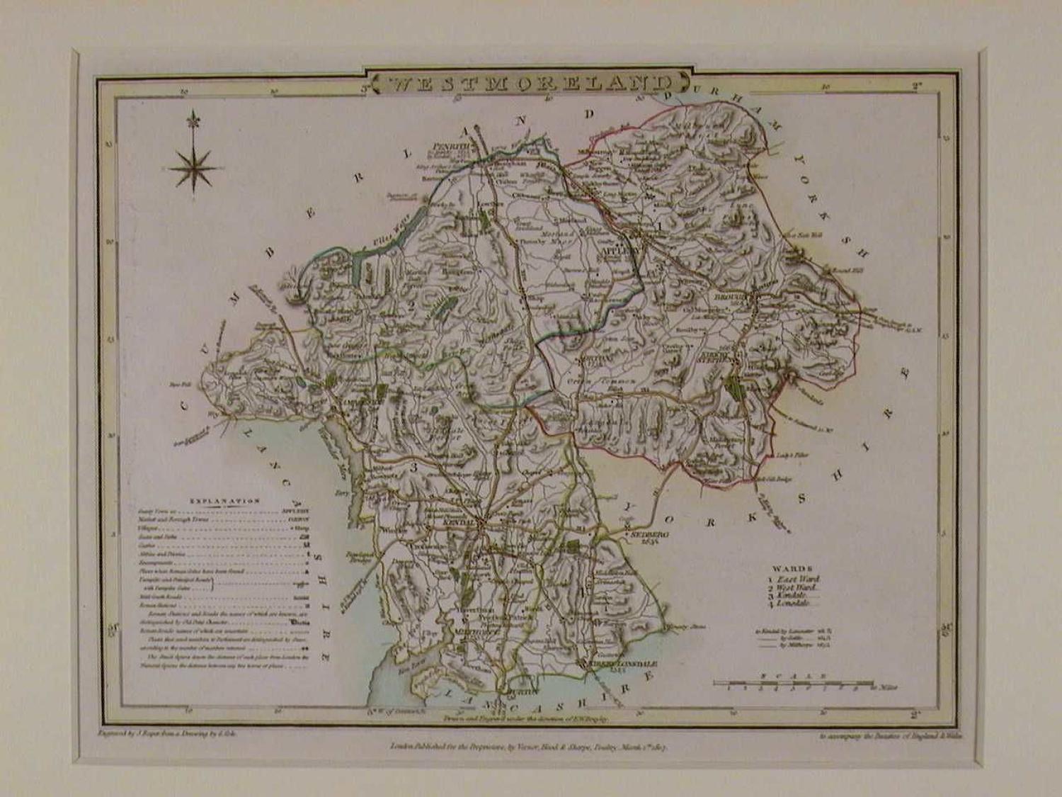
Code: 47732
Author: G Cole / J Roper
Date published: 1810
First edition. Copper engraved map on Whatman paper with original hand colouring. Overall size in off white fully conservation mount and backing : 38.3cms x 34cms. Image size: 228mm x 181mm. The map has a compass indicator, a list of the Hundreds, and an Explanation key listing the symbols for villages, turnpikes, Mail Coach roads Roman stations, etc. Very good condition G.Cole, the cartographer and J.Roper, the engraver together produced a finely engraved series of county maps and town plans which were issued in parts between 1804 and 1810. The maps were based on the work of John Cary and Charles Smith and were some of the last maps to be published before the arrival of the railways.