Mostlymaps |
Tel: +44 (0)1497 820539 Email: info@mostlymaps.com Web site: https://www.mostlymaps.com/ |
|
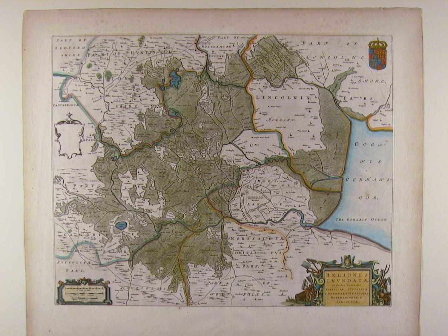
Code: 48989
Author: Johannes Blaeu
Date published: 1648-1662
Copper engraving, original hand colouring. Size : 64.2cms.x 54.2cms. Latin text to verso; pages 222/221. Age toning and some spotting top right blank and top margin and one fox spot in German ocean else very good condition indeed. Showing the Fens and the Wash including parts of Norfolk, Suffok, Cambridgeshire, Huntingdonshire, Northamptonshire and Lincolnshire. The map shows the drainage dykes Cornelis Vermuyden, a Dutchman, was appointed by Charles I to use his expertise in the draining of the Fens. Blaeu established his firm in 1599 as instrument and globe makers. He went on to produce some of the highest quality atlases ever published see information in our background information section.