Mostlymaps |
Tel: +44 (0)1497 820539 Email: info@mostlymaps.com Web site: https://www.mostlymaps.com/ |
|
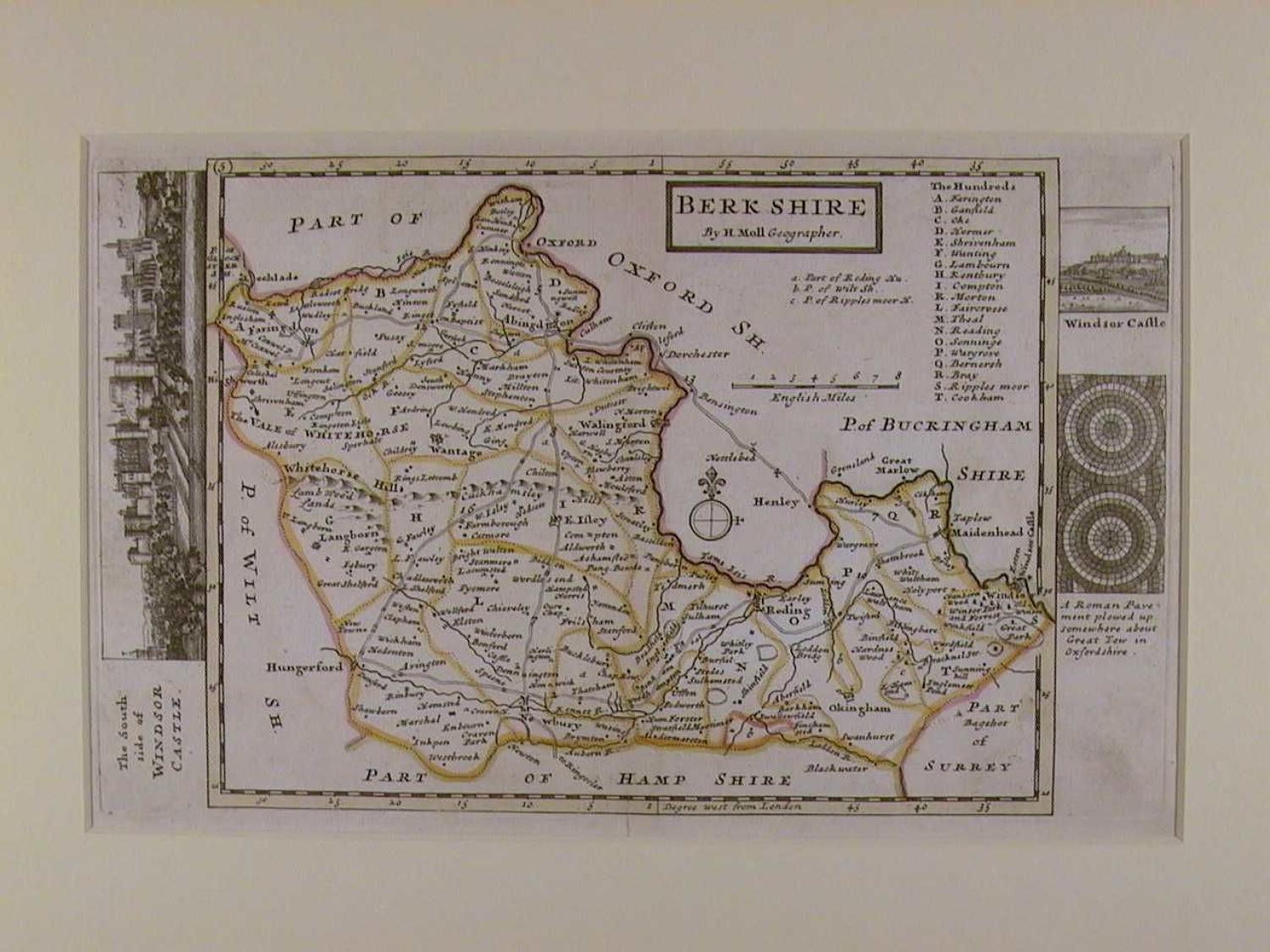
Code: 49111
Author: Moll, Herman
Publisher: Geography of England and Wales
Date published: 1747
Copper engraving ; original outline hand colouring. Overall size in off white fully conservation grade mount and backing : 44.8cms x cms. Image size (including the decorative margin of antiquities) 300 mm x 188mm. Vignette view of The South side of Windsor Castle in left margin and Windsor castle and Roman pavement right margin. Key to the Hundreds. Centrefold as issued; Small, faint brownish mark bottom left blank below the Roman Pavement else very good condition. Dutchman, Herman Moll was a bookseller, geographer and engraver. Around 1678 he moved to London where for a while he continued as an engraver. Later, he started his own business as a map publisher and by the turn of the century had become the most prominent map publisher in the country. In 1724 he published his 'New Description of England and Wales' an atlas of the English and Welsh counties. The maps themselves are very attractive and clearly laid out and on either side of each map's border are illustrated relics and antiquities associated with the county.His work had a high reputation and was much copied by other publishers. Moll also had a gift for making interesting friends and these included Daniel Defoe, Jonathan Swift (he provided maps for Robinson Crusoe and Gulliver's Travels), explorer/buccaneers William Dampier and Woodes Rogers and the scientist Robert Hooke.