Mostlymaps |
Tel: +44 (0)1497 820539 Email: info@mostlymaps.com Web site: https://www.mostlymaps.com/ |
|
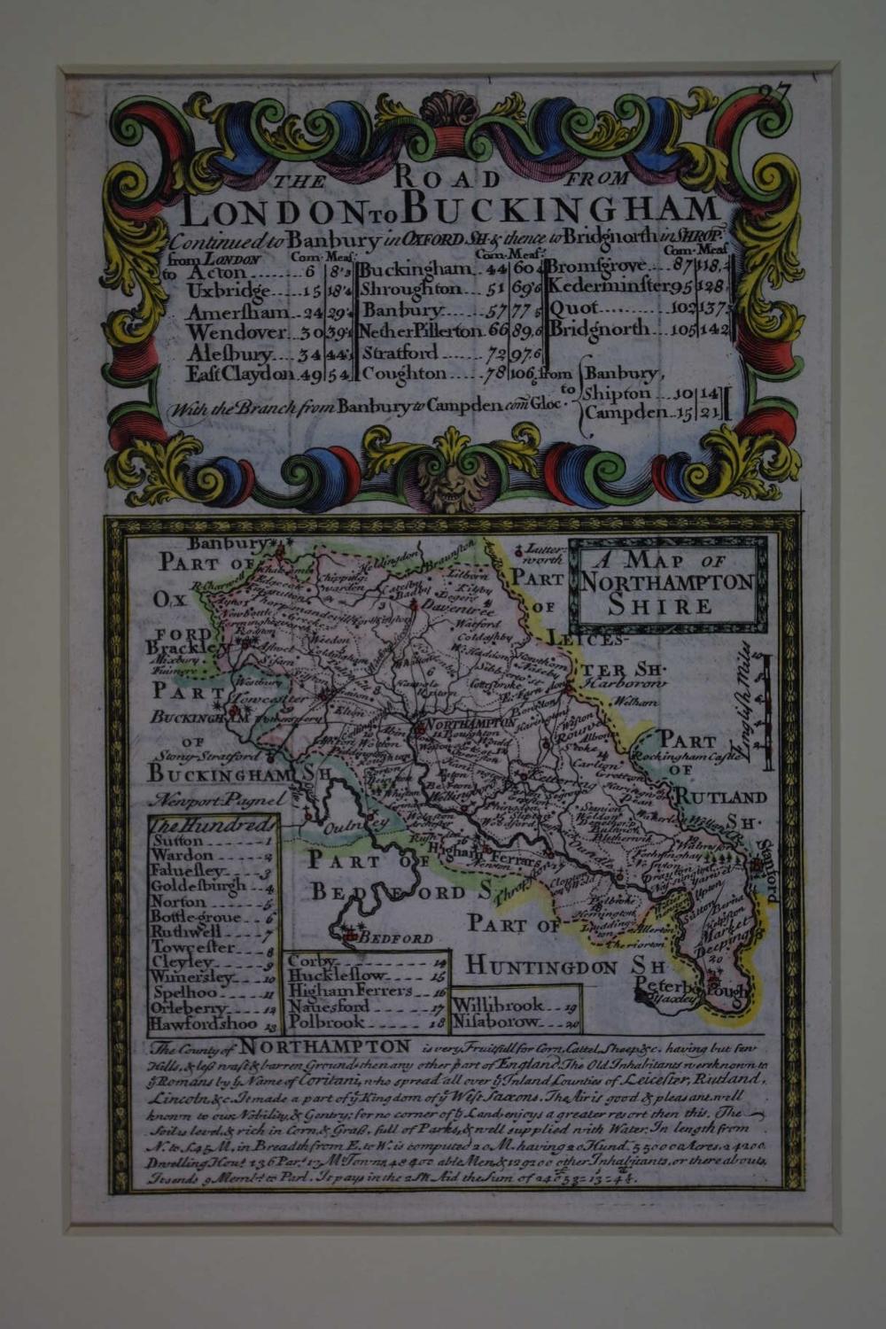
Code: 50430
Author: Owen, John & Bowen, Emanuel
Publisher: Britannia Depicta
Date published: 1720circa
County Map. Copper engraving with later hand colouring. Overall size in hinged off white fully conservation mount and back (so floating freely apart from two pieces of archival tape) : 26.8cms x 34.3cms. Engraved size : 113mm x 183mm. Description of county below map..about 24200 Houses and : is very Fruitfull for Corn, Cattel, Sheep etc having but few Hills & less wast & barren Ground than any other part of England. The Old Inhabitants were known to ye Romans by ye Name of Coritani who spread all over ye Inland Counties of Leicester, Rutland, Lincoln &tc It made a part of ye Kingdom of ye West Saxons. The Air is good & pleasant, well known to our Nobility & Gentry ; for no corner of ye Land enjoys a greater resort then this.. The verso (uncoloured) has the road from London to Amersham (no 28). Very good condition apart from a little show through in the blank areas. Emanuel Bowen, in collaboration with John Owen, engraved the maps for the half-scale reduction of Ogilby's road maps of 1675. The need for a smaller version to take on coach travel was supplied by their Britannia Depicta and was first published in 1720 : The Whole for its Compendious Variety & Exactness, preferable to all other Books of Roads hitherto Published or Proposed ; And calculated not only for the direction of the Traveller (as they are) but the general use of the Gentleman and Tradesman. This set of maps was very popular and had many re-issues and was probably the most successful of the pocket road maps combining as it did individual county maps followed by a set of strip road maps.