Mostlymaps |
Tel: +44 (0)1497 820539 Email: info@mostlymaps.com Web site: https://www.mostlymaps.com/ |
|
Code: 51114
Author: John Ogilby
Publisher: Britannia,or an Illustration of the Kingdom of England and Dominion of Wales; by a Geographical and Historical description of the Principal roads thereof.
Date published: 1698
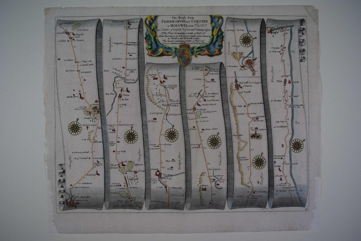
No. 98. Long title:Shrewsbury and Chester to Holywel.The roads from Shrewsbury and Chester to Holywel com: Flint. The first containing 52 miles 4 furlongs : From Shrewsbury to Ellesmere 16 miles, to Wrexham 12.4 to Mould 13 to Holywell 11 miles.The second containing 17 miles 4 furlongs : From Chester to Flint 12.4 and to Holywell 5m. Approx. overall sheet size : 47.4cms.x 39cms. Copper engraving with later hand colouring. Archival repairs to bottom right and left margin (some 9.5cm each side), this repair would be covered by a mount else very good condition. John Ogilby is regarded by many as the most important name in British Cartography after Christopher Saxton. He was born in Edinburgh in 1600 and led a varied life embracing many different careers. He started life as a dancing teacher and followed this with a spell as tutor to the children of the Earl of Stafford. Next he went to Dublin where he ran a theatre successfully until the Civil War in 1641. He nearly lost his life in the Irish troubles and returned to London destitute. After a time in Cambridge as a literary translator he found favour at Court and was responsible for organising the coronation revels. After another sojourn in Dublin he set up business as a printer and publisher in London but this venture was destroyed in the Great Fire of London in 1666. After the fire he was appointed one of four "sworn viewers"" who were ordered to survey those parts of the city that had been destroyed