Mostlymaps |
Tel: +44 (0)1497 820539 Email: info@mostlymaps.com Web site: https://www.mostlymaps.com/ |
|
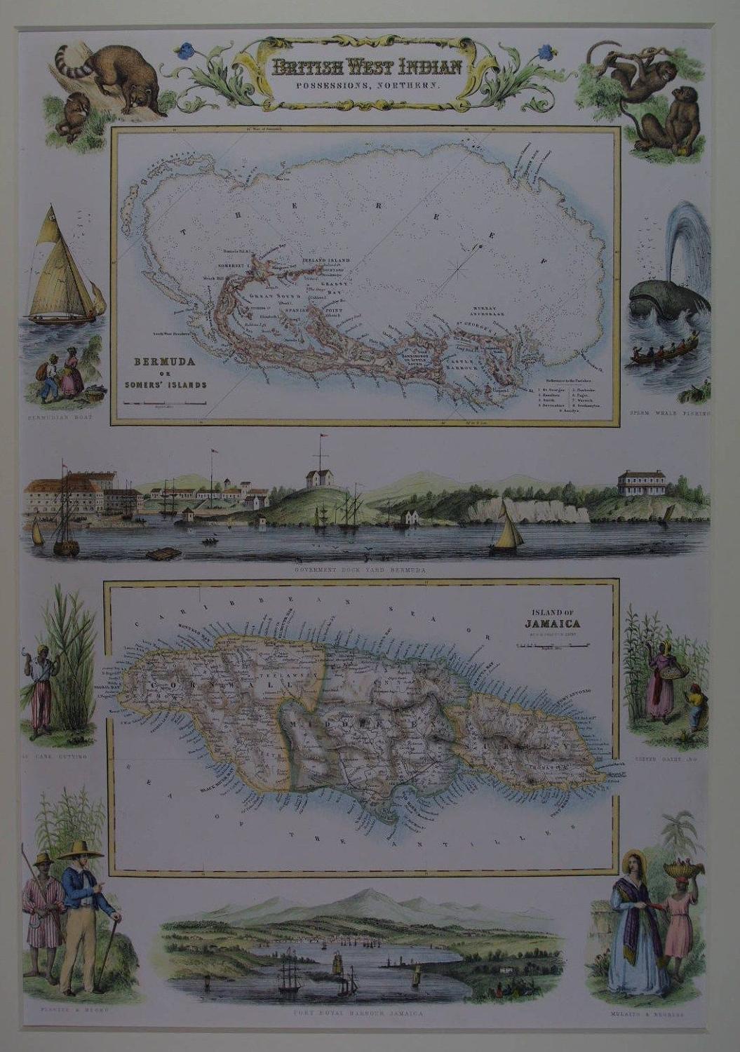
Code: 51342
Author: Fullarton, Archibald
Date published: 1860 circa
Long title: British West Indian Possession, Northern. Two maps: Bermuda or Somers' Islands and, below, Island of Jamaica. Panorama of Government Dock Yard Bermuda inbetween the two maps. Vignettes around the margins including Planter & Negro, Mulatto & Negro, Sugar Cane cutting, Coffee cutting, Bermudian Boat, Sperm Whale fishing. Lithograph with original and later hand colouring Overall sheet size in off white fully conservation grade mount and back: 45.3cms x 61.2 cms; image size: 310mm x 456mm including imprint at bottom. Very good condition. Archibald Fullarton and Company were a Glasgow based publisher operating towards the end of the nineteenth century. The company produced a number of atlases, and books containing maps, including Fullarton's Parliamentary Gazetteer Of England And Wales and The Royal Illustrated Atlas, Of Modern Geography. The latter publication featured attractively decorated maps such as this example, with small vignette views of local interest surrounding the engraved map.