Mostlymaps |
Tel: +44 (0)1497 820539 Email: info@mostlymaps.com Web site: https://www.mostlymaps.com/ |
|
Code: 51347
Author: Fullarton, Archibald
Date published: 1860 circa
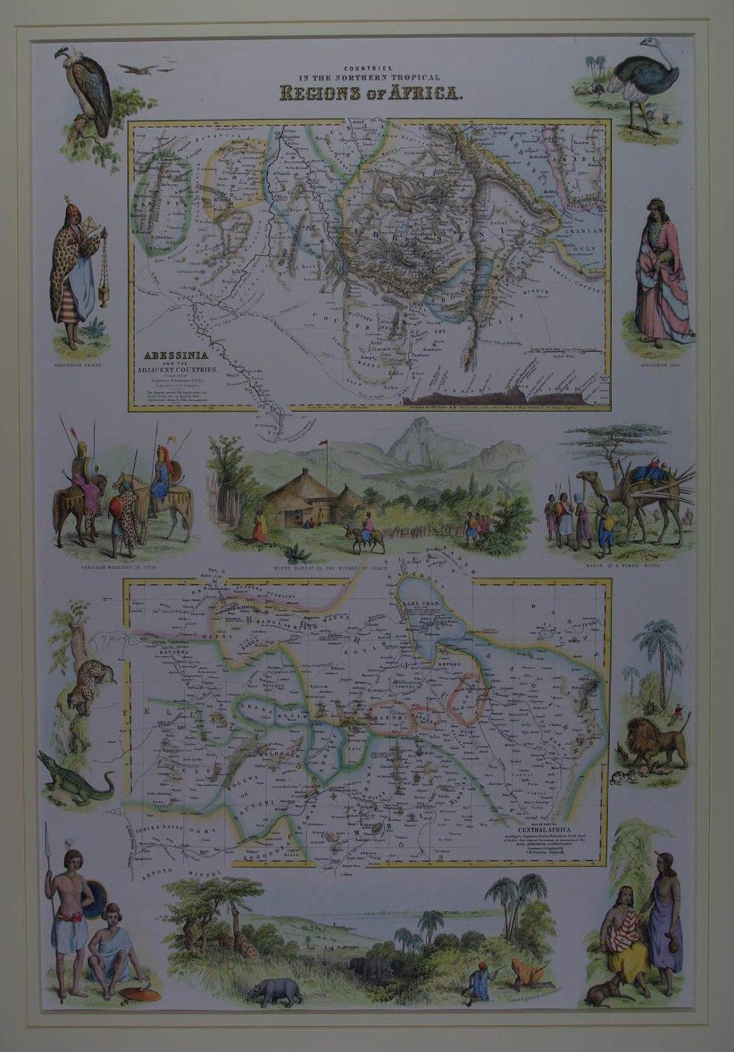
Long title:Countries in the Northern Tropical Regions of Africa. Lithograph with original and later hand colouring. Two maps. Abessinia and the Adjacent Countries constructed by Augustus Petermann FRGS. Engraved GH Swanston.Second: Map of Part of Central Africa according to Clapperton,Denham, Richardson,Barth, Vogel,& Baikie; from Original Documents in possession of the Royal Geographical Society of London Constructed & Engraved by GH Swanston, the lower map showing Lake Chad and the adjacent region to the south and west (now northern Cameroun and eastern Nigeria). This map is decorated with vignettes of Lake Tsad, Mount Mamrat, indeginous wildlife and an Abyssinian priest, Abyssibian lady, Adaiel and Shoho Warriors, Adaiel and Tibbus females, and Christian warriors of Shoa. Overall sheet size in off white fully conservation grade mount and back decorated with a v grove: 45.4cms x 60.4 cms; image size: 310mm x 460mm. Archibald Fullarton and Company were a Glasgow based publisher operating towards the end of the nineteenth century. The company produced a number of atlases, and books containing maps, including Fullarton's Parliamentary Gazetteer Of England And Wales and The Royal Illustrated Atlas, Of Modern Geography. The latter publication featured attractively decorated maps such as this example, with small vignette views of local interest surrounding the engraved map.