Mostlymaps |
Tel: +44 (0)1497 820539 Email: info@mostlymaps.com Web site: https://www.mostlymaps.com/ |
|
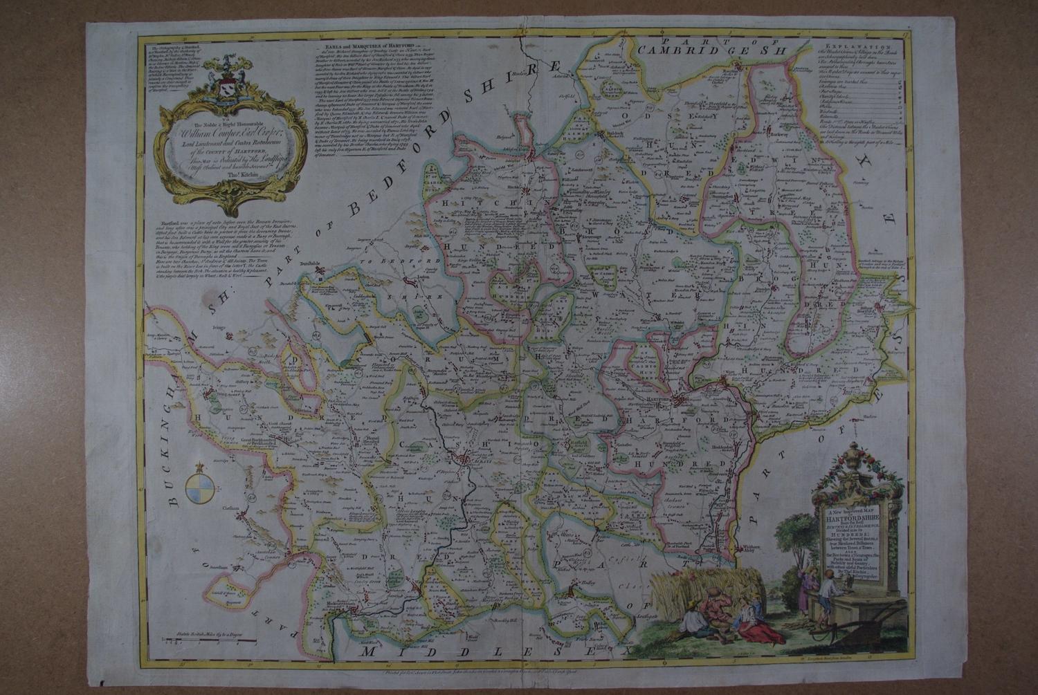
Code: 51670
Author: Bowen, Emanuel & Kitchin, Thomas
Publisher: The Large English Atlas
Date published: 1762
Long title: A New Improved Map of Hartfordshire from the Best Surveys and Intelligence, Divided into its Hundreds ; Shewing the Several Roads and true Measured Distances between Town and Town. Also the Rectories & Vicarages; the Parks and Seats of the Nobility and Gentry; with other useful Particulars. Copper engraving. Later hand colouring. Overall size : 77cms.x 59.4cms. Image size : 650mm.x 526mm. Decorative cartouche at bottom right; dedication cartouche at top left; scale of distance at bottom left. Centre fold as issued; some archival strengthening to bottom of centrefold and to about eight nicks to the edge of the map (one is 4 cms but does not touch map and is barely noticeable); little greyness in blank areas, possibly C18th printing residue else stunning, large, detailed map in good condition. The Large English Atlas was the finest county atlas produced in the 18th.Century and was the largest scale atlas produced to date. Clearly engraved in detail with views and panels of text in the areas surrounding each county describing the commerce and the state of the principal cities. Uncommon