Mostlymaps |
Tel: +44 (0)1497 820539 Email: info@mostlymaps.com Web site: https://www.mostlymaps.com/ |
|
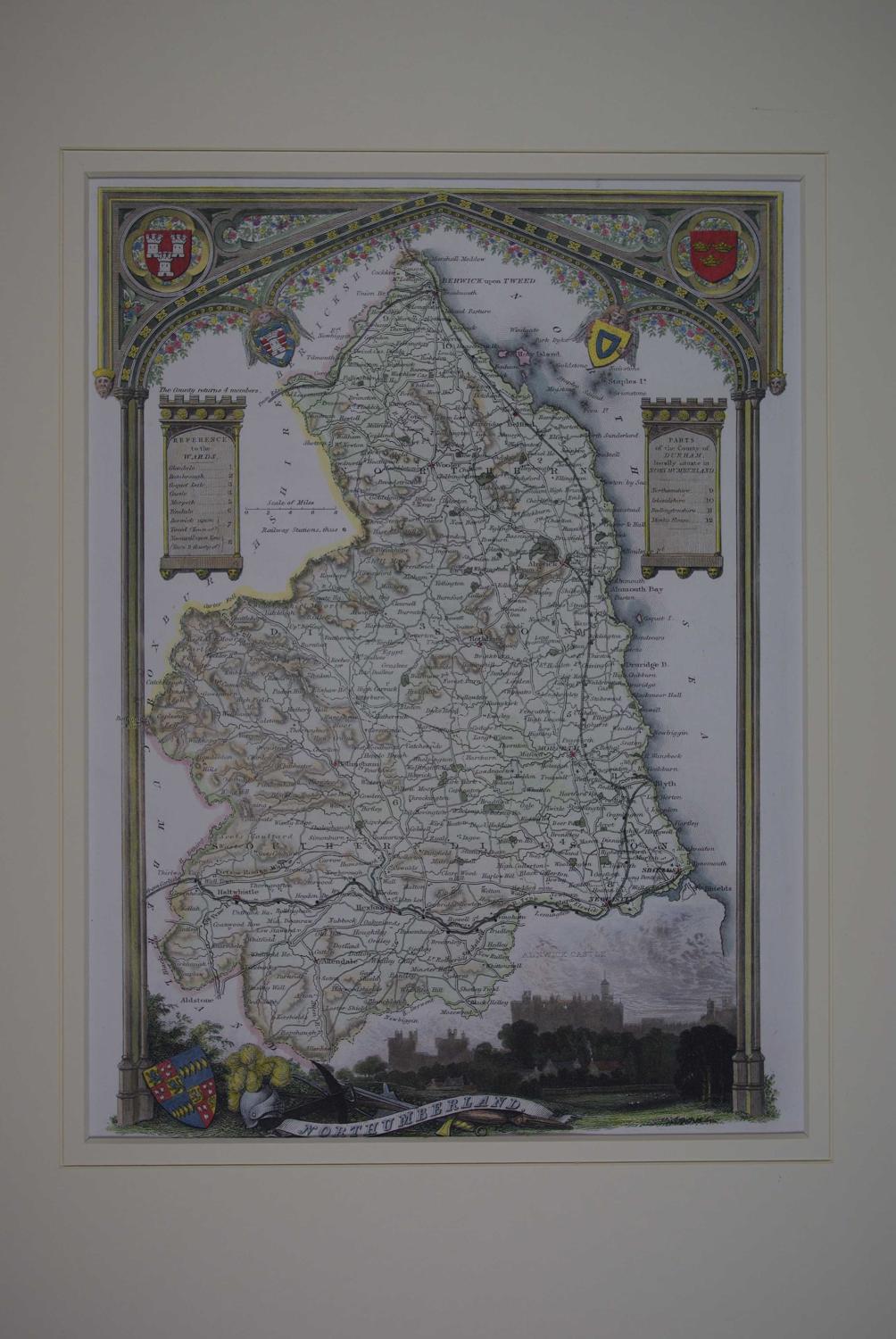
Code: 52498
Author: Moule, Thomas
Publisher: Barclays Dictionary.
Date published: 1845 circa
Steel engraving ; later hand colouring. Off white fully conservation grade mount and back with v groove decoration to the hinged mount. Overall size: 34.5cms x 42.5cms. Image size : 192mm x 268mm. Very good condition apart from a little loss to the ribbon title due to the thread bottom margin as usual. Highly decorative map. Thomas Moule (1784-1851) was a scholar and writer on heraldry and antiquities who worked in London as a bookseller and later on worked in the Lord Chamberlain's department. The county maps for which he is best known were first published in the 1830's during the reign of William IV and re-issued in 1841, during the reign of Victoria. The original steel plates were used for all issues, but they were amended in the later edition to show the railways. These maps are very attractive and clearly printed. They were the last series of highly decorated maps to be published and they are very collectable both for their attractive and distinctive appearance and for the very fine quality of the engraved detail.