Mostlymaps |
Tel: +44 (0)1497 820539 Email: info@mostlymaps.com Web site: https://www.mostlymaps.com/ |
|
Code: 52802
Author: Jansson, Johannes
Date published: 1646 circa
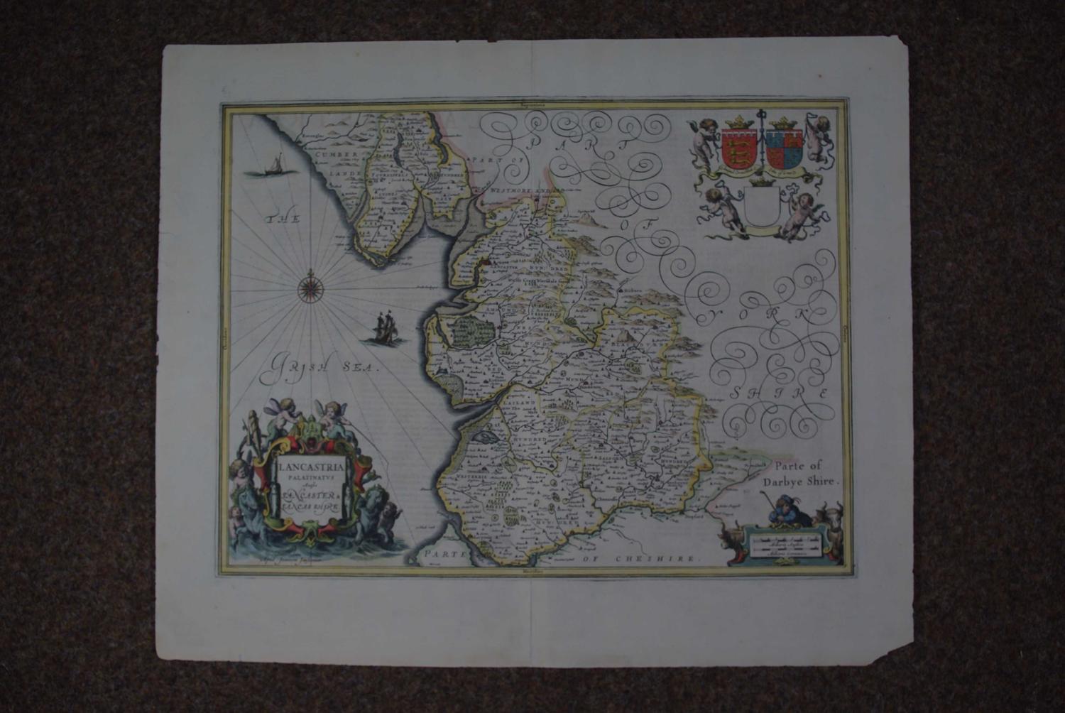
Long title: Lancastria Palatinatus anglis Lancaster & Lancashire. Copper engraving with original hand colouring. Overall sheet size: 59.3cms x 48cms; image size: 499mm x 378mm. Little show through in left blank; bottom right corner missing; 28cms strengthening on centrefold and 7cms from top centrefold on verso, eleven repaired nicks at margin edge repaired else good. Decorative title cartouche. Armorials. Scale of distance at bottom right. Latin text on verso (pp 318/317). Highly decorative map with stunning title cartouche featuring putti and neptune's horses, fish,nets etc ; two sailing ships in the Irish sea, three armorials held aloft by putti; scale of distance cartouche flanked either side by cows with bucolic herdsman leaning on the top of the cartouche emphasizing the farming side of Lancashire's occupations. One tiny crack, visible only when held up to the light and barely worth mentioning - the map itself has no faults, the margins have three repaired wormholes right and left, now virtually invisible, old repair on verso to top and bottom of centrefold; odd speck in margin but very good nonetheless.