Mostlymaps |
Tel: +44 (0)1497 820539 Email: info@mostlymaps.com Web site: https://www.mostlymaps.com/ |
|
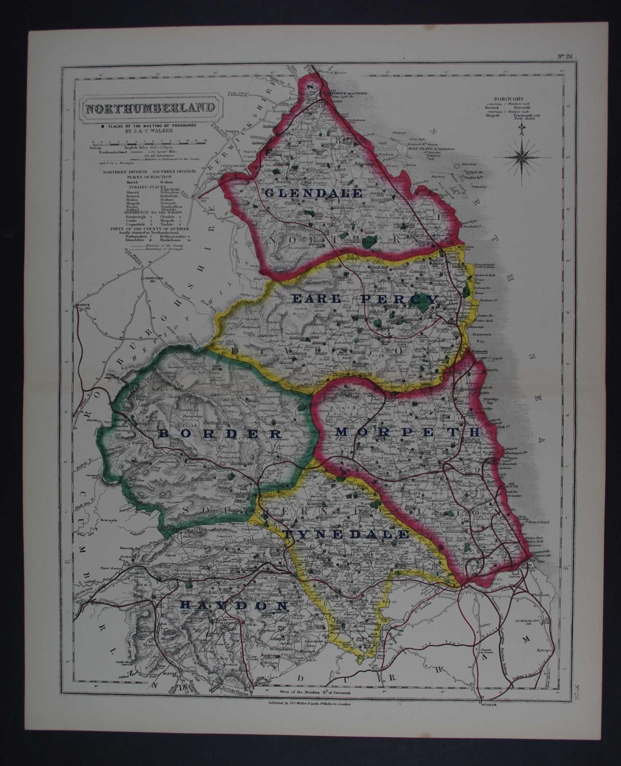
Code: 52863
Author: Walker, J & C
Publisher: Hobson's Fox-hunting Atlas
Date published: 1850
Lithograph ; original outline hand colouring. Overall unmounted size ; 36cms x 44.2cms. Image size: 320mm x 400mm. The black circles mark the places of the meeting of foxhounds. Centrefold as issued. Northumberland contains 1871 Square miles with 303568 Inhabitants. Railways, Place of Election, the six Wards, Polling Stations are also marked. Very good condition. John and Charles Walker were engravers and publishers, and were responsible for several atlases, including those published by the Society for the Diffusion of Useful Knowledge. In 1837 they produced the 42 county maps on which this work is based. Hobson used maps printed from the Walkers' lithographic plates, and added features relevant to fox-hunting: the range of each hunt is outlined in watercolour, and the places of the meets are indicated by black spots.