Mostlymaps |
Tel: +44 (0)1497 820539 Email: info@mostlymaps.com Web site: https://www.mostlymaps.com/ |
|
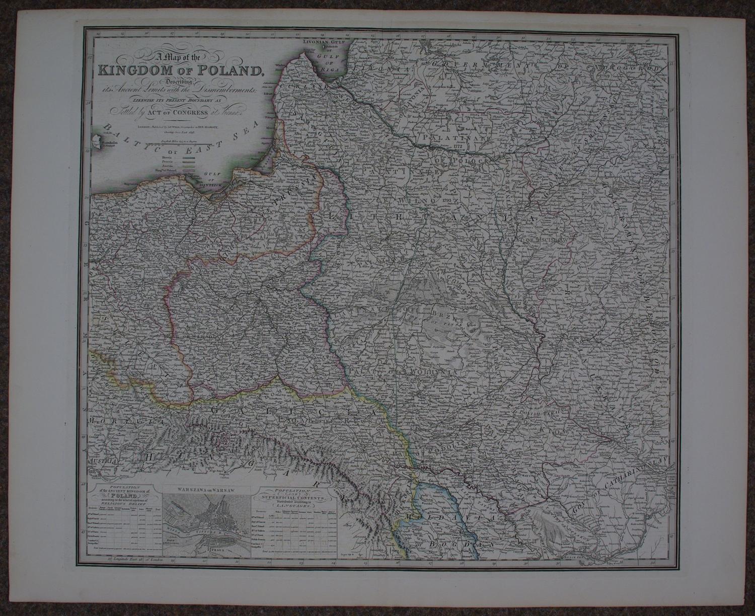
Code: 53494
1829
Long title: A Map of the Kingdom of Poland, Describing its Ancient Limits with the Dismemberments;Likewise it’s Present Bounday as Settled by Act of Congress at Vienna. Steel engraving with original outline hand colour denoting the regions owned by Russia, Prussia, Austria and the Kingdom of Poland. Overall sheet size: 74cms x 59.6cms; image size: 610mm x 576mm. Originally published with a different title by William Faden in 1799. The map is based on the Rizzi-Zannoni 24-sheet map of 1772 that was commissioned by the King of Poland. An inset contains a bird's-eye plan of Warsaw flanked by tables of information concerning the population, religion, and languages. Very good condition apart from faint offsetting in town plan.