Mostlymaps |
Tel: +44 (0)1497 820539 Email: info@mostlymaps.com Web site: https://www.mostlymaps.com/ |
|
Code: 53542
Date: 1864
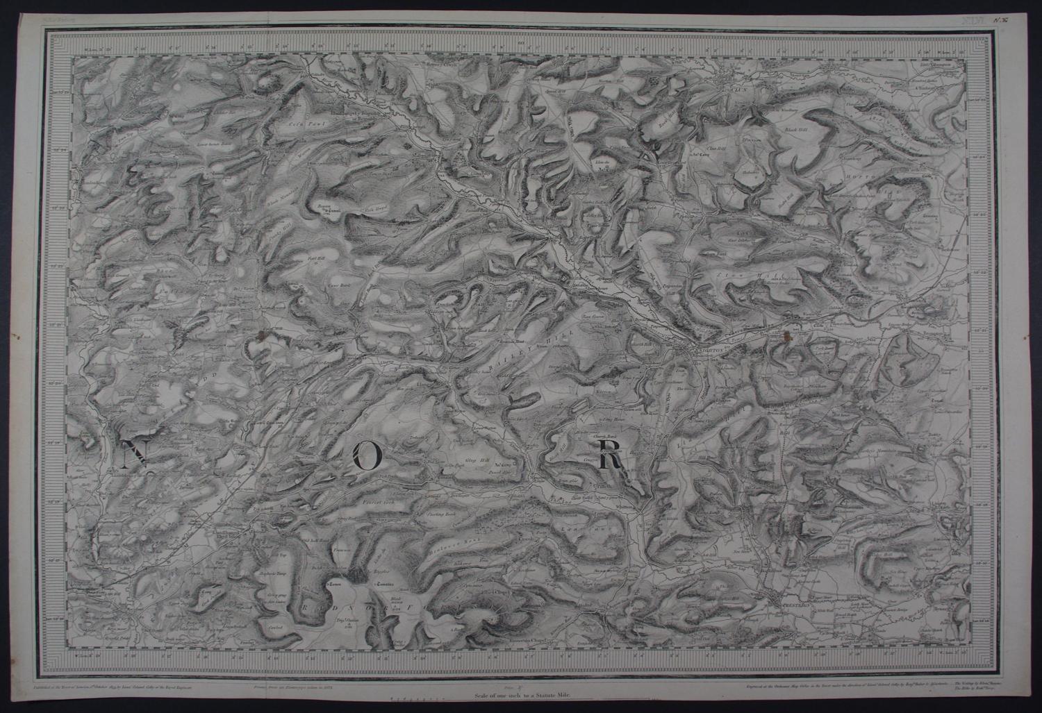
One Inch to One Statute Mile. Electrotyped in 1872. Engraved at the Ordnance Map Office in the Tower under the direction of Lieut Colonel Colby by Benjamin Baker and his Assistants. Overall sheet size : 50.9cms x 34.3cms; image size: 478mm x 336 mm inc imprint. Knighton mid right, Presteign bottom right , Radnor Forest bottom left. Roman camps tumuli marked; two brown spots else very good condition.