Mostlymaps |
Tel: +44 (0)1497 820539 Email: info@mostlymaps.com Web site: https://www.mostlymaps.com/ |
|
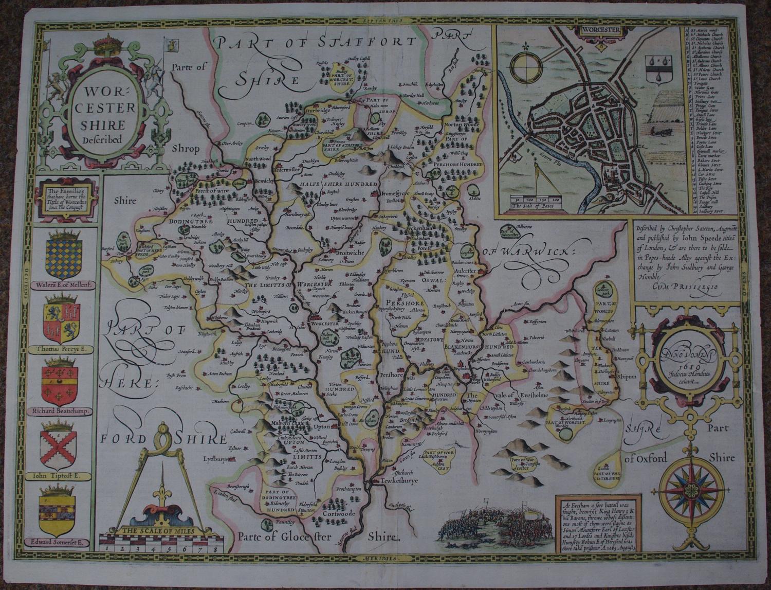
Code: 53622
Date:1611
First edition. Copper engraving ; later hand colouring. Overall size : 52.2cms x 40.9cms . Image size : 506mm.x 379mm. English text to verso. Plan of city of Worcester. Centre fold as issued. Slight repaired crack top margin into map just above the ‘R’ of Stafford and two virtually invisible wormhole repair top margin and one bottom margin also three repaired wormholes around the cartouche containing Jodocus Hondius’ name; several tiny pinpricks when held up to the light else a good dark impression as one would expect of this rare first edition. Flaws reflected in price but barely visible at all from the front.
Unfortunately, there are no surviving records of how many examples of the First Edition (or indeed of any edition) were printed. One might speculate that the First Edition could have numbered between about five hundred and one thousand examples. It should be remembered that market for maps was not well developed in England in 1612. This, together with the cost of the atlas, the need for a second edition soon afterwards, and the high quality of impressions from the third, Latin text, edition of 1616, suggests that the first print-run may have been closer to five hundred copies or so. Unfortunately, until an attempt is made at a census of surviving examples, these figures can be regarded as only the roughest of estimates. Ashley Baynton-Williams see http://www.mapforum.com/02/speed.htm