Mostlymaps |
Tel: +44 (0)1497 820539 Email: info@mostlymaps.com Web site: https://www.mostlymaps.com/ |
|
Code: 53779
Date: Circa 1665
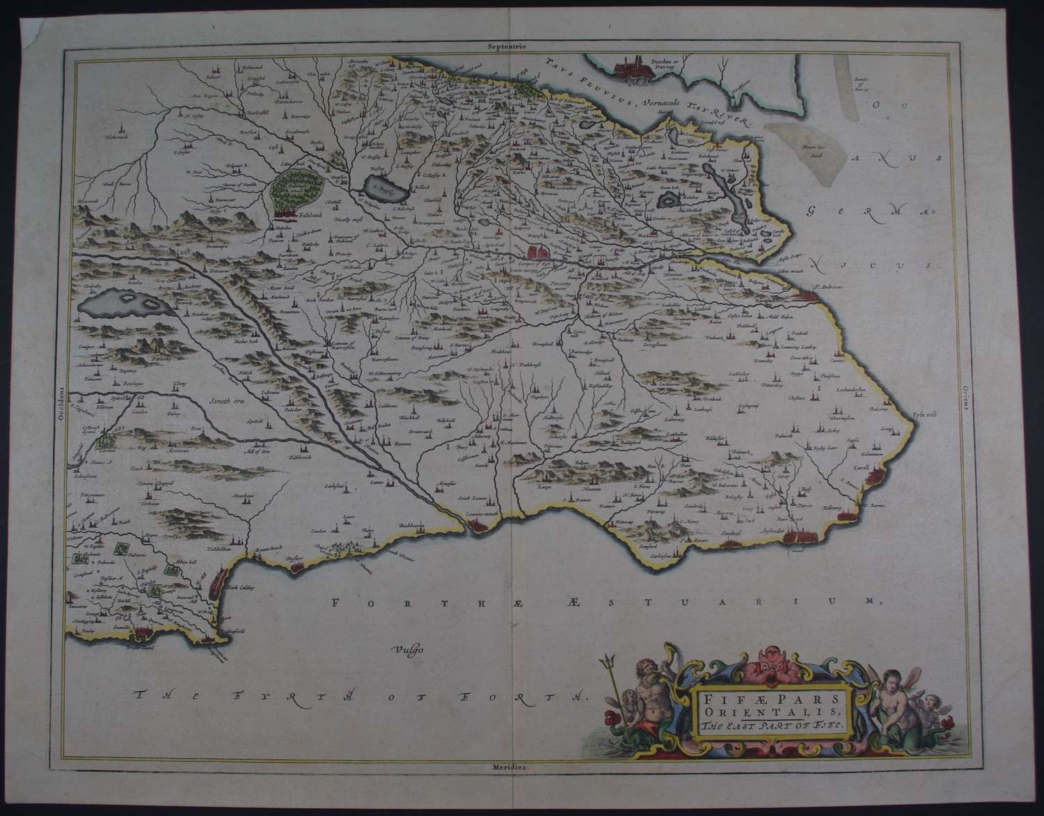
Long title: Fifae Pars Orientalis, The East Part of Fife. Copper engraving with both original and later hand colouring. Dutch text verso, pp 104/103. The map covers modern-day Dunfermline, Kirkcaldy, St Andrews, Dysert KirkCaldy , Kilrumy etc t etc. Overall sheet size: 57.9 cms x 45.5cms; image size: 526mm x 416mm.
Top left margin tip replaced with old paper ; some overall toning else very good condition.
This map was based on the surveys and sketches of minister, Timothy Pont, born 1565. His manuscrips were redrawn by Robert Gordon and then published by the Blaeu family.
Translation of a portion of the text verso reads: ‘ The town of St Andrews was till recently the religious centre of the entire region, seat of the Archbishopric and home to the Muses. Its famous University is not the least of its ornaments. It has a most agreeable situation by the sea, a satisfactory port, rich catches of fish and the surrounding countryside is most agreeable’.
Publication of Blaeu's New World Atlas, or "Atlas Novus" was originally begun by Johannes's father Willem Blaeu with the publication in 1635 of two volumes (delineating The World, Europe, Arctic, Scandinavia, Russia, Eastern Europe, Germany and the Low Countries; and France, Spain, Asia, Africa and America), and published in four languages (German, Dutch, Latin and French). After succeeding his father, Johannes Blaeu expanded the "Atlas Novus" to six volumes by 1655, and this formed the first half the "Atlas Maior," extending to 11 or 12 volumes by 1662. Their maps represent the pinnacle of Dutch mapmaking in the C16th.