Mostlymaps |
Tel: +44 (0)1497 820539 Email: info@mostlymaps.com Web site: https://www.mostlymaps.com/ |
|
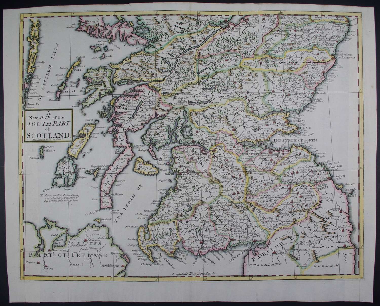
Code: 54043
Date: 1722
Copper engraving with later hand colouring. Overall size : 48.1cms x 39.2cms . Engraved size : 449mm.x 354mm. Centre fold as issued. The Western Isles on left, Arran and part of Northern Ireland and south down to Carlisle and Newcastle-upon-Tyne. New borders (with old, contemporary paper) and neatline and border professionally re-instated in manuscript, now virtually indistinguishable . Otherwise very good condition.
These maps are the first county maps to show roads ( based on Ogilby’s road maps ) and show three scales representing great, middle and small miles as different scales were used in different parts of the country. The extremely rare John Bill maps of the 1620’s were the first to carry latitude and longitude which Morden shows here too : longitude (measured from the meridian of St. Paul’s Cathedral) given in the form of time in minutes at the top of the map , usually in Roman numerals, and at the bottom in degrees.