Mostlymaps |
Tel: +44 (0)1497 820539 Email: info@mostlymaps.com Web site: https://www.mostlymaps.com/ |
|
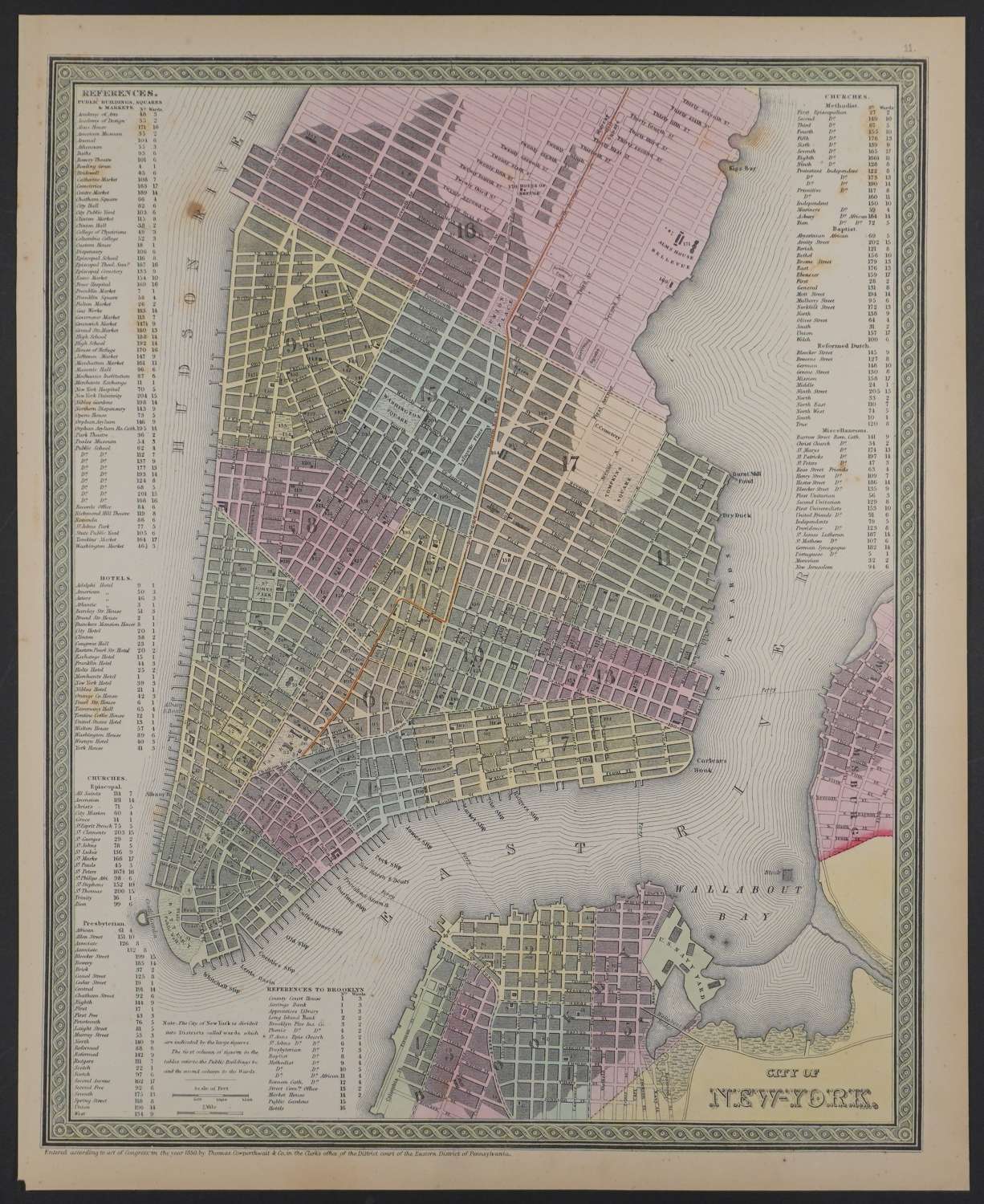
Code: 54157
Date: 1855
Town plan. Published 1855 in Pennsylvania, dated 1850 . Lithograph with original full wash hand colouring. Overall sheet size: 34.2cms x 42.2cms; image size: 317mm x 397mm. Characteristic green decorative border and pastel colouring. The map is hand coloured by wards, with keys naming public buildings squares and markets; hotels, churches; and a key for Brooklyn all around the edges of the map. One large fox spot in Hudson River and some fainter foxing in the key on the left side and some on right side in key only. One faint spot above Brooklyn key else good condition.
This is one of the earliest maps of NYC to appear in a commercial atlas.
Thomas, Cowperthwait & Co. were a publishing company based in Philadelphia. They were part of the burgeoning atlas and map publishing in the early to mid-nineteenth century. They published many famous works, including Tanner’s New Universal Atlas. Their maps are notable for the decorative borders and fine, vivid original hand colouring.