Mostlymaps |
Tel: +44 (0)1497 820539 Email: info@mostlymaps.com Web site: https://www.mostlymaps.com/ |
|
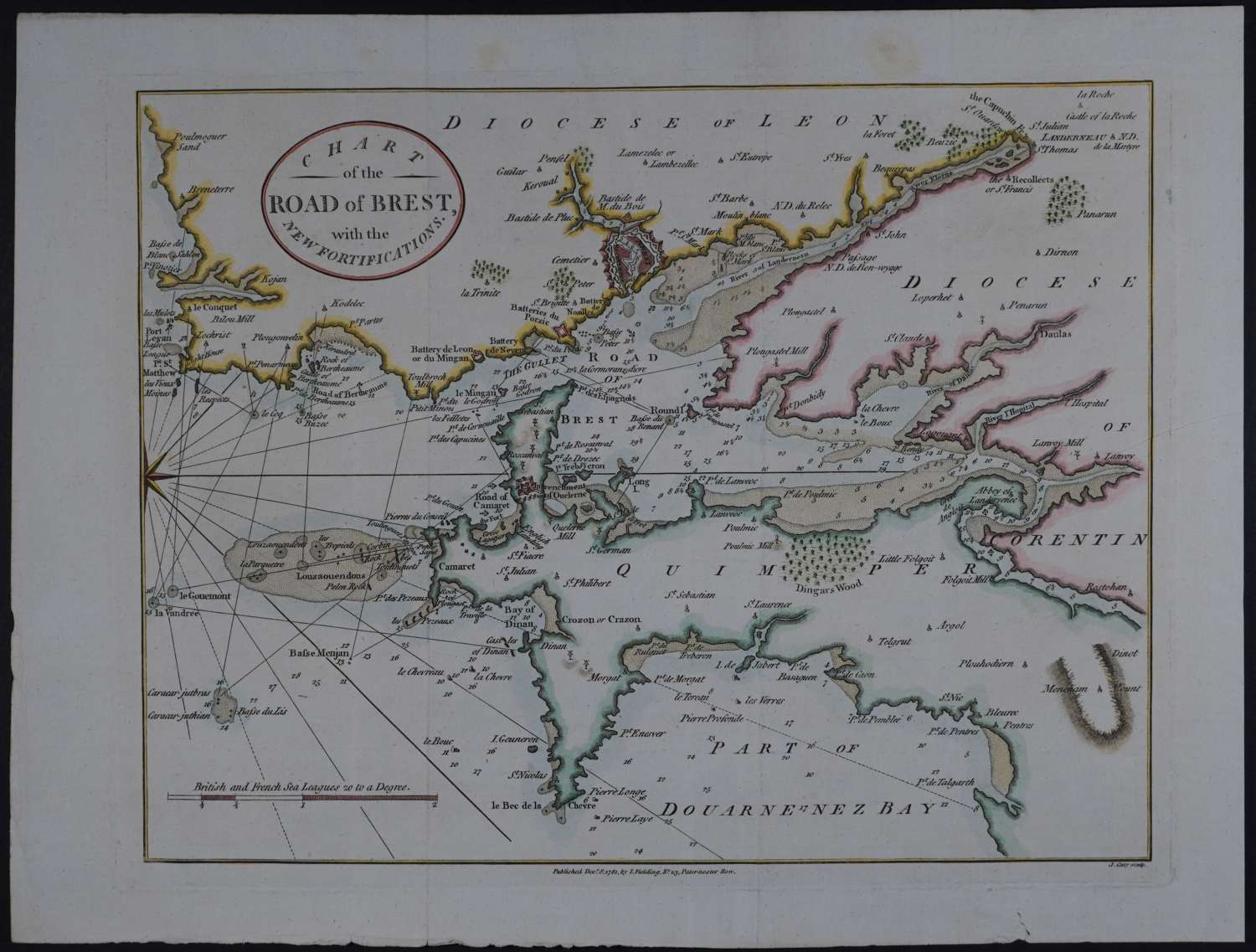
Code: 54184
Date: 1781
Copper engraving; later hand colouring. Overall sheet size: 34.2cms x 25.9 cms; image size: 281mm x 221. Attractive and informative chart at a time when the British and French were engaged in the American War of Revolution with engagements in Europe, for example: A naval engagement off Ferrol, Spain took place in 1782 when the British ship HMS Mediator commanded by James Luttrell successfully attacks a convoy of French and American ships attempting to supply the United States. Knowledge of coasts and seas was of huge importance. Old folds as issued. Ownership stamp: T Smerham and in ms No 14 on verso of map, not visible from front. One slight edge tear bottom margin else very good condition.