Mostlymaps |
Tel: +44 (0)1497 820539 Email: info@mostlymaps.com Web site: https://www.mostlymaps.com/ |
|
Code: 54265
Date: 1855
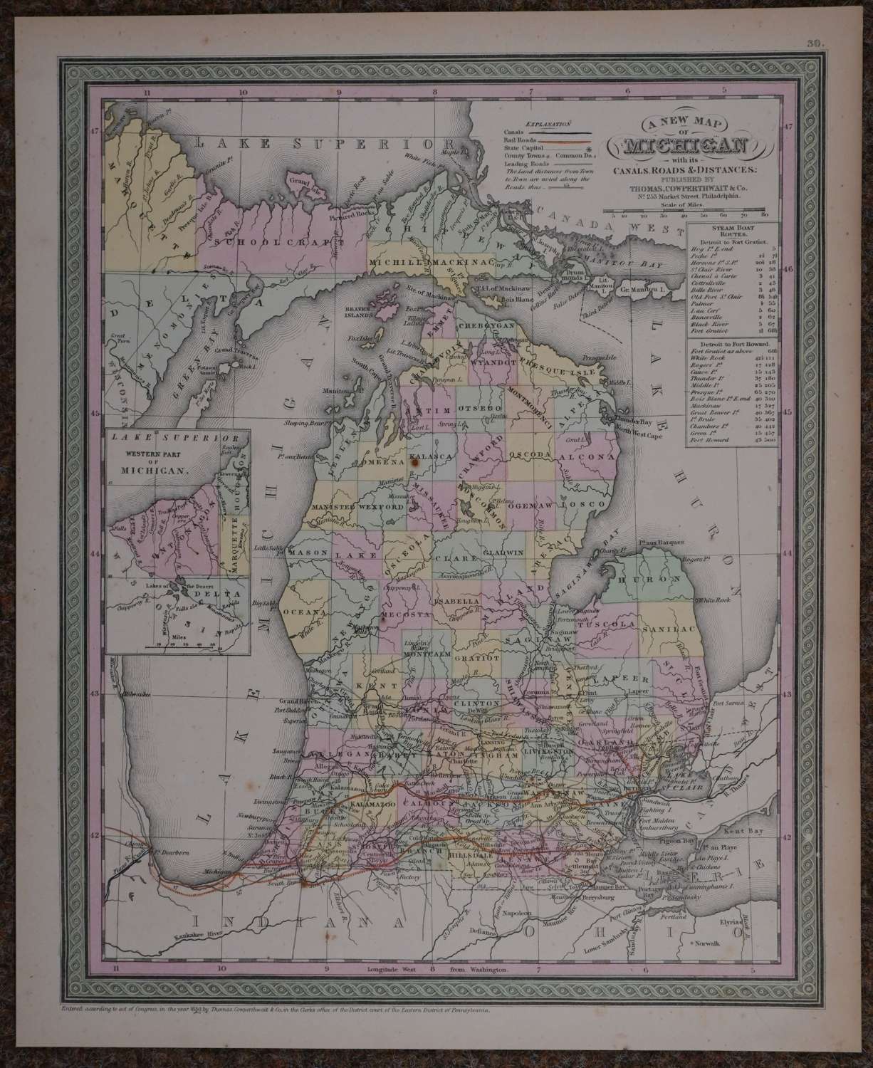
Published 1855 in Pennsylvania, dated 1850 . Lithograph with original full wash hand colouring; hand coloured by county. Overall sheet size: 33.1cms x 40.6cms; image size: 298mm x 375mm. Characteristic green decorative border and pastel colouring. Steam Boat routes from Detroit to Fort Gratiot and Detroit to Fort Howard with Explanation Key above left showing symbols for canals , Rail Roads, Leading Roads, County Towns etc . Railroads marked in orange/red. One rust spot in Kalasca and faint one towards bottom of Lake Michigan else good condition.
Thomas, Cowperthwait & Co. were a publishing company based in Philadelphia. They were part of the burgeoning atlas and map publishing in the early to mid-nineteenth century. They published many famous works, including Tanner’s New Universal Atlas. Their maps are notable for the decorative borders and fine, vivid original hand colouring.