Mostlymaps |
Tel: +44 (0)1497 820539 Email: info@mostlymaps.com Web site: https://www.mostlymaps.com/ |
|
Code: 54384
Date: 1646
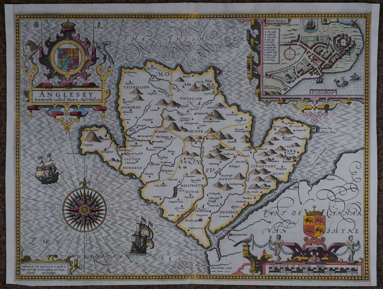
Copper engraving; later hand colouring. Overall size : 53cms x 40.4cms. Image size : 512mm x 383mm. Compass rose, title in cartouche, inset plan of Beaumaris (mapped by Speed himself as the,’scale of pases at the bottom of the town plan is thought to indicate). English text on verso. Centrefold as published. Margins augmented left and right with old paper to facilitate mounting and framing. Engraved by Jodocus Hondius with his trademark herring bone or shot silk hatching in the sea. Very good condition.
Until his late thirties, John Speed was a tailor by trade but his passion for history and map-making led him to gain a patron in Sir Fulke Greville, the poet and statesman, who found him a post in the customs and helped subsidize his map-making, giving him “full liberty to express the inclination of my mind”. He became aquainted with the publisher William Camden, whose descriptive text was used by Speed for most of the maps in his atlas “The Theatre of Empire of Great Britain” published most probably in 1612 although it bears the date 1611 on the main title page. The maps were engraved in Amsterdam by Jodocus Hondius, one of the foremost engravers of his time. Speed’s maps are unique historical documents of their time and the town plans featured on the maps are in most cases the first information we have of their early apppearance. Their artistry has guaranteed the collectability of these maps in the centuries that have followed.