Mostlymaps |
Tel: +44 (0)1497 820539 Email: info@mostlymaps.com Web site: https://www.mostlymaps.com/ |
|
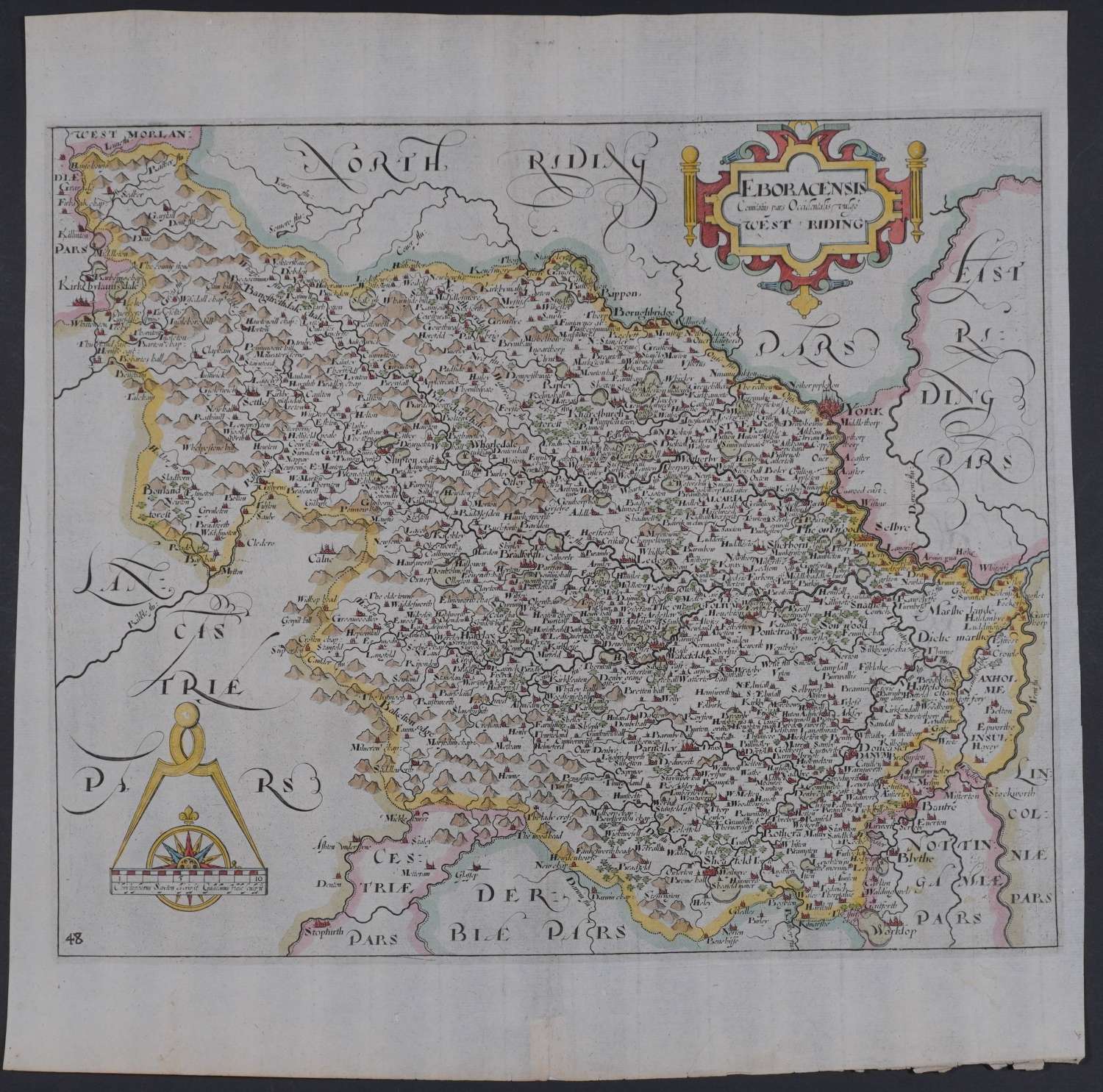
Code: 54597
Date: 1637
Long title: Eboracensis Comitatis pars Occidentalis vulgo West Riding. The Saxton map is of the whole of Yorkshire, therefore this example is one of the earliest printed maps of the West Riding without the other two Ridings (deriving from the word Thridings, the Anglo - Saxon word for three). Blank verso; number 48 engraved bottom left. Copper engraving with later hand colouring. Overall size : 41.2cms x 33.3cms. Image size: 315mm x 263mm. Title in decorative cartouche, scale of distance surmounted by dividers, bottom left. Watermarked paper; blank verso. Centre fold as published. Imperceptible darkening in blank areas from original inkiness from the printing plate else very good condition of a highly detailed and very decorative map (small strengthening bottom of centrefold on verso).
These maps are the first county maps where each county is delineated on a separate sheet. They were prepared by William Kip and William Hole for William Camden’s famous work , Britannia and were based on the maps of Saxton and Norden and the Anonymous William Smith series. There were three editions: 1607, 1610 and 1637. See Skelton, County Atlases Of The British Isles 6.