Mostlymaps |
Tel: +44 (0)1497 820539 Email: info@mostlymaps.com Web site: https://www.mostlymaps.com/ |
|
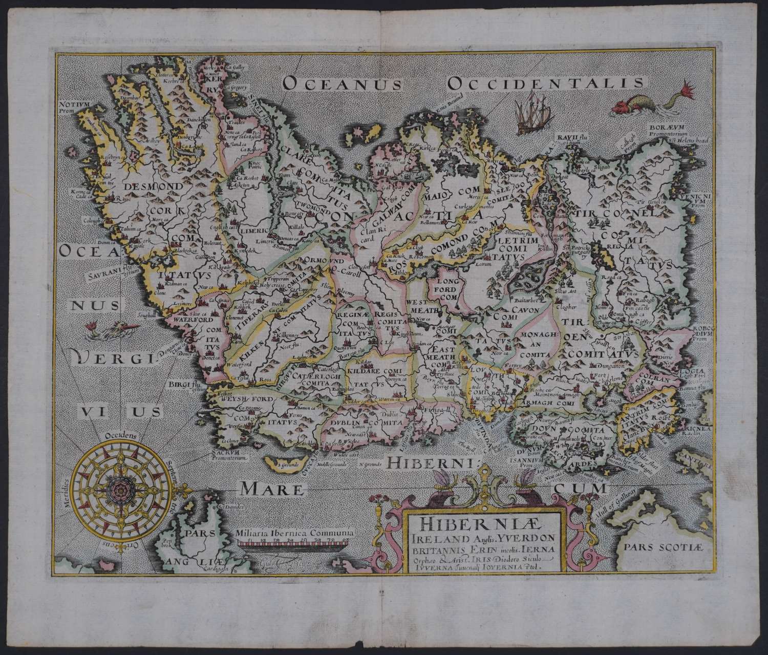
Code: 54606
Date: 1610
Long title: HIBERNIAE / IRELAND ANGLIS. YVERDON / BRITANNIS ERIN INCOLIS. / ERNA / ORPHEO & ARIST. IRIS DIODORO SICULO / IVVERNA IUVENALI IOYERNIA PTOL. Copper engraving with hand colouring. Orientation of the North to the right following the Mercator/Hondius outline. Overall unmounted size : 38.1cms x 30.8cms ; Image size : 331mm x 263mm. Title in cartouche. Sailing ship, sea monster, compass rose with rhumb lines radiating out and scale of distance. Watermarked paper. Centrefold as issued; a few marks to the margins and one small loss to bottom margin and extreme right tip else a stunning map in very good condition.`
This series of maps were the first in which each county was deliniated on a separate sheet. They were prepared by William Kip and William Hole and were mainly based on those of Christopher Saxton and Norden. The first issue of these maps was in 1607 with Latin text on the back of the maps and as the paper on which they are printed is rather thin, the lettering sometimes shows through on to the front of the map. In the subsequent two editions of 1610 and 1637 the maps had no text on the back and plate numbers were added to many maps for the 1637 edition. The maps were not issued again. The layout , calligraphy and general appearance of these maps are very similar to their Saxton counterparts. They were the first to carry the new Arms of James 1st with the unicorn replacing the dragon as a supporter.
