Mostlymaps |
Tel: +44 (0)1497 820539 Email: info@mostlymaps.com Web site: https://www.mostlymaps.com/ |
|
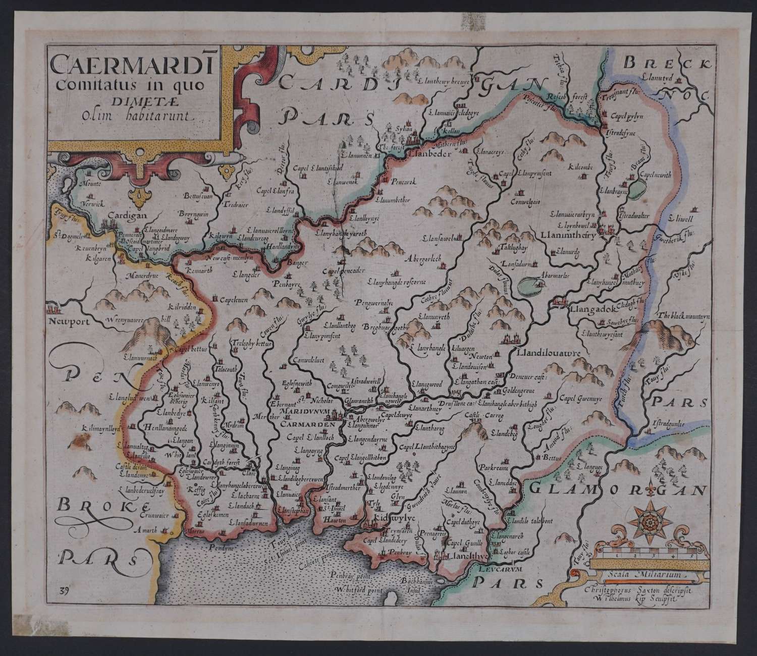
Code: 54588
Date: 1637
Long title:Caermardi Comitatus In Quo Dimetae Olim Habituerunt. Copper engraving with later but not recent hand colouring. Overall sheet size: 36.2cms x 30.8cms. Image size: 317mm x 268mm. Title in cartouche top left and scale of distance surmounted by small compass rose, bottom right. Centre fold as published and slight horizontal crease through centre. Watermarked paper; faint mount staining to margins from old framing and similarly some tape staining in margin - see photographs- else good condition.
These maps are the first county maps where each county is delineated on a separate sheet. They were prepared by William Kip and William Hole for William Camden’s famous work ,’Britannia’ and were based on the maps of Saxton and Norden.